
Length 24.45 km | Counties: Carroll | |
 | ||
County | ||
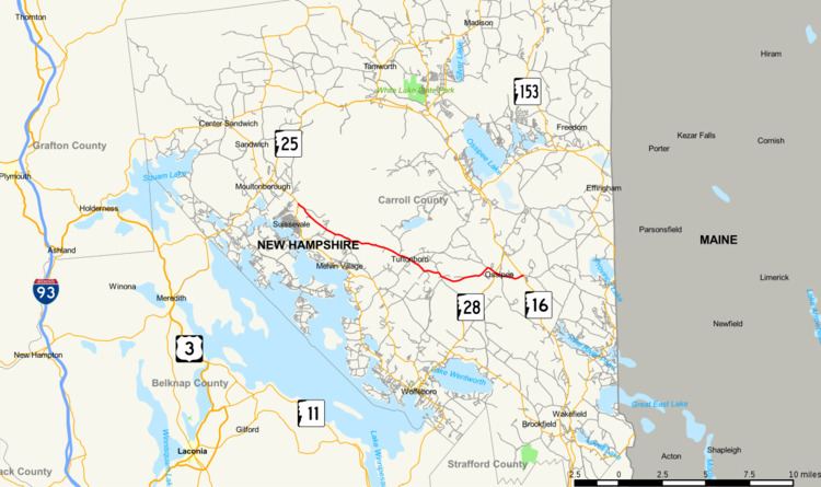
New Hampshire Route 171 (abbreviated NH 171) is a 15.194-mile-long (24.452 km) east–west highway in southern Carroll County in the Lakes Region of New Hampshire. The highway runs from NH 109 in Moultonborough to NH 16 in Ossipee.
Contents
Map of NH-171, New Hampshire, USA
Route description
NH 171 begins at an intersection with NH 109 (Governor John Wentworth Highway) in the town of Moultonborough. The two-lane highway heads east as Mountain Road, which passes along the southern flank of the Ossipee Mountains, including Mount Roberts, Turtleback Mountain, and Mount Shaw, and by the Castle in the Clouds. NH 171 continues through the town of Tuftonboro, where the route crosses the Melvin River and passes to the south of Dan Hole Pond. The highway enters the town of Ossipee at the community of Water Village, the namesake of the highway's name in the town. NH 171 crosses Poland Brook and intersects NH 28. The highway parallels Poland Brook east along Old Granite Road, which passes through the town center of Ossipee before reaching the route's eastern terminus at NH 16 (White Mountain Highway) just north of its crossing of Poland Brook.
Major intersections
The entire route is in Carroll County.