
Existed: 1976 – present Length 18.7 km | Constructed 1976 | |
 | ||
North end: I‑80 Bus. / SR 223 in Wells | ||
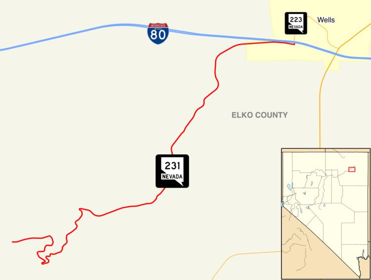
State Route 231 (SR 231) is an unsigned state highway in Elko County, Nevada, United States. Known as Angel Lake Road, the highway connects Angel Lake to the town of Wells. SR 231 is a Nevada Scenic Byway.
Contents
Map of NV-231, Wells, NV 89835, USA
Route description
SR 231 begins at the Angel Lake fee booth, providing access to the lake and nearby picnic and campground areas. From there, the highway heads in a general eastward direction, descending through switchbacks along the east side of the East Humboldt Range. Once traveling about 5.5 miles (8.9 km) to clear of the mountains, the road turns more sharply to the north. The final 1.5 miles (2.4 km) sees the route turn more directly eastward to enter the town of Wells. SR 231 comes to its northern terminus at the intersection of Angel Lake Road and Humboldt Avenue (SR 223) in Wells, just south of Interstate 80. Angel Lake Road may be closed to travel during winters.
History
Angel Lake Road became a state highway on July 1, 1976.
State Route 231 was designated a Nevada Scenic Byway on June 30, 1995.
Major intersections
The entire route is in Elko County.