
Existed: 1992 – present Constructed 1992 | Length 21 km | |
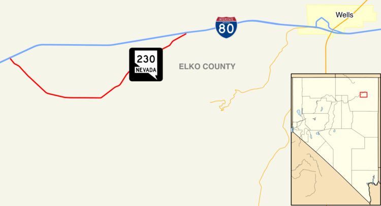 | ||
State Route 230 (SR 230) is a state highway in the U.S. state of Nevada. It is a southern loop route off of Interstate 80 (I-80) between Elko and Wells, serving the communities of Deeth and Welcome and various ranches within Starr Valley. The road follows a "U" shaped path entirely within Elko County, and passes close to the East Humboldt Range. The road was constructed by the early 1960s and designated a state highway by the early 1990s.
Contents
Map of NV-230, Wells, NV 89835, USA
Route description
SR 230 begins at Interstate 80 (I-80) at the Starr Valley Interchange, exit 333. The road heads southward into the community of Deeth, where it meets CR 753. After crossing over the Humboldt River, SR 230 meets Starr Valley Loop, which continues south to SR 229, and crosses the Humboldt River, heading eastward. After about 1.7 miles (2.7 km), the route turns northeast, passing near the edge of the Humboldt National Forest. The road then turns abruptly northward to meet its end at the Welcome Interchange, exit 343 of I-80.
History
The road has existed as Starr Valley Road since 1962, even before I-80 replaced U.S. Route 40 (US 40) in the area. After I-80 was designated in the area, the bridge over I-80 in Deeth was completed in 1965, and the bridge at the east terminus in 1968. The bridges over the Humboldt and Mary's Rivers were completed in 1983. It was not until 1992, however, until this road was formally designated a state highway by NDOT. Since establishment, the alignment of the route has not changed.
Major intersections
The entire route is in Elko County.