
Existed: 1976 – present Counties: Churchill Constructed 1976 | Southwest end: US 95 south of Fallon Length 10.07 km | |
 | ||
Northeast end: SR 119 southeast of Fallon | ||
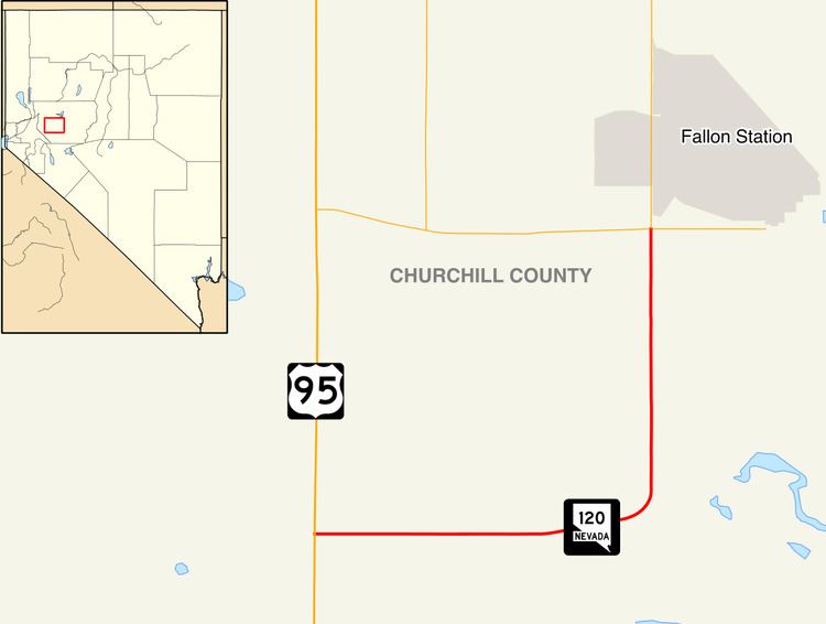
State Route 120 (SR 120) is a state highway in Churchill County, Nevada. It connects U.S. Route 95 (US 95) to State Route 119 just outside Naval Air Station Fallon.
Contents
Map of NV-120, Fallon, NV 89406, USA
Route description
State Route 120 begins south of the city of Fallon, at the intersection of US 95 and Pasture Road. From there, the route follows Pasture Road eastward through agricultural and farm lands south of Fallon. After about 3 miles (4.8 km), the route comes close to the northern shore of Carson Lake. At this point, the highway turns northward to traverse through more agricultural areas. SR 120 reaches its terminus at the southwest corner of Naval Air Station Fallon, at the intersection of Pasture Road and Berney Road (SR 119), although Pasture Road continues north to access the airbase.
History
SR 120 was designated in 1976.
Major intersections
The entire route is in Churchill County.