
Admin. region Köln Elevation 220 m (720 ft) Area 50.64 km² Local time Friday 10:54 PM Dialling code 02247 | District Rhein-Sieg-Kreis Time zone CET/CEST (UTC+1/+2) Population 20,634 (31 Dec 2010) Postal code 53819 | |
 | ||
Weather 7°C, Wind E at 11 km/h, 68% Humidity | ||
Neunkirchen-Seelscheid is a municipality in the Rhein-Sieg district in the southern part of North Rhine-Westphalia, Germany. Beside the two principal places Neunkirchen and Seelscheid there are numerous smaller localities among the municipality.
Contents
- Map of 53819 Neunkirchen Seelscheid Germany
- Geography
- Neighbour municipalities
- Subdivisions
- Population
- History
- Politics
- Twin towns
- References
Map of 53819 Neunkirchen-Seelscheid, Germany
Geography
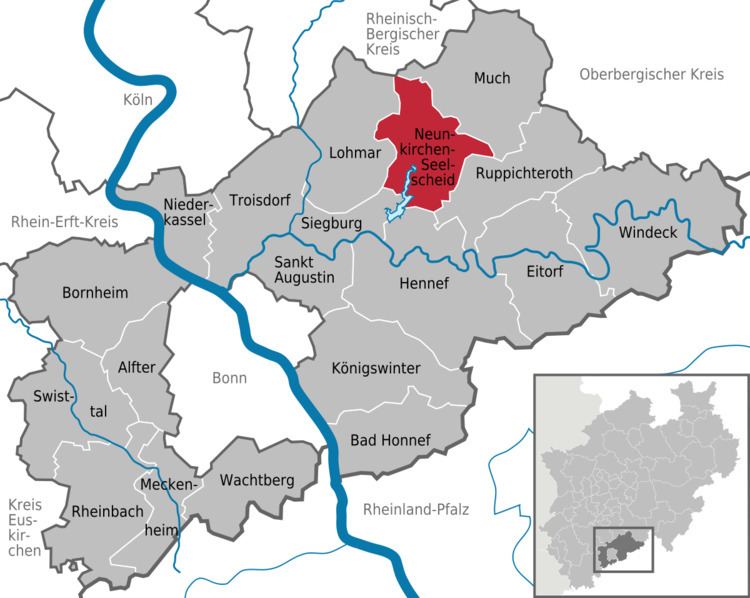
Neunkirchen-Seelscheid is located 20 km north-east of Bonn and 25 km south-east from Cologne in the southern part of the region of Berg (Bergisches Land). The northwest municipality border is formed by the river course of the Naafbach, while the Bröl acts as the southeast border. The Wahnbach flows through the municipality.
Neighbour municipalities
Neighbouring cities are Siegburg, Hennef, Overath and Lohmar. Neighbouring municipalities are Much and Ruppichteroth.
Subdivisions
Beside the two principal places Neunkirchen (5423) and Seelscheid (5788) there are following localities within the municipality (population between brackets)
Balensiefen (20), Birken (58), Birkenfeld (174), Birkenmühle (5), Brackemich (106), Breiderheide (3), Breitscheid, Bruchhausen (59), Busch (14), Effert (2), Eich (101), Eischeid (508), Gutmühle (39), Hardt (43), Hasenbach (315), Hausen, Hausermühle (71), Heidgen, Heister (110), Herkenrath (137), Hermerath (342), Hermerather Mühle, Herrenwiesermühle, Hochhausen (397), Hohn (101), Höfferhof, Hülscheid (418), Ingersau (62), Ingersaueler Mühle (6), Kaule (37), Kotthausen, Köbach (112), Krahwinkel (200), Meisenbach, Mohlscheid (383), Nackhausen (319), Niederhorbach (164), Niederwennerscheid (507), Oberdorst (364), Oberheister (413), Oberhorbach (64), Oberste Zeith, Oberwennerscheid (432), Ohlig (10), Ohmerath (31), Pinn (45), Pixhof, Pohlhausen (492), Rehwiese (6), Remschoß (254), Rengert (222), Renzert (64), Rippert (128), Schaaren, Scherpekotten (2), Scherpemich, Schöneshof (454), Siefen (34), Söntgerath (134), Stein (125), Steinermühle (19), Straßen (84), Unterste Zeith, Wahlen (22), Wahn (197), Weiert (32), Wende (4), Weesbach, Wiescheid, Wolperath (1288)
Population
History
Politics
The 34 seats of the municipal council consist of: