
Admin. region Düsseldorf Elevation 40 m (130 ft) Area 83.64 km² Population 41,736 (31 Dec 2010) Dialling code 0 | District Viersen Time zone CET/CEST (UTC+1/+2) Local time Friday 8:22 PM Postal code 41334 Administrative region Düsseldorf | |
 | ||
Weather 11°C, Wind NE at 14 km/h, 57% Humidity | ||
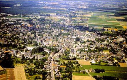
Nettetal is a municipality in the district of Viersen, North Rhine-Westphalia, Germany.
Contents
- Map of 41334 Nettetal Germany
- Geography
- Division of the town
- Lakes
- Sights
- International relations
- Notable people
- References
Map of 41334 Nettetal, Germany
Geography
Nettetal is not a town itself, but a federation of villages that have developed around the river Nette, and the worked-out gravel pits that now form twelve lakes. It is situated on the border with the Netherlands, approximately 20 km north-west from Mönchengladbach and 10 km south-east from Venlo.
Division of the town
Nettetal consists of the following parts (2005 population in brackets):
The main town of Nettetal is Lobberich, which owes its past wealth from the local German lace industries which developed greatly before the First World War, and the town has an impressive late Victorian Church. During the Second World War the older Church was pierced by an American high-explosive shell, the crater of which can still be seen in the wall.
Lakes
Nettetal features a high number of lakes
At the river Nette:
At the river Renne:
At the river Königsbach:
Sights
International relations
Nettetal is twinned with: