
Administrative district Neryungrinsky District Local time Friday 10:43 PM | Town Neryungri | |
 | ||
Municipal district Neryungrinsky Municipal District Weather -11°C, Wind SW at 5 km/h, 85% Humidity | ||
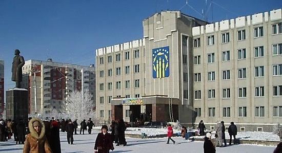
Neryungri (Russian: Нерюнгри; [ˈnʲerʲʊnɡrʲɪ]; Yakut: Нүөрүҥгүрү, Nüörüñgürü, [nyøɾyŋgyɾy]) is the second largest town and the administrative center of Neryungrinsky District in the Sakha Republic, Russia. As of the 2010 Census, its population was 61,747.
Contents
- Map of Neryungri Sakha Republic Russia
- Etymology
- History
- Administrative and municipal status
- Economy
- References
Map of Neryungri, Sakha Republic, Russia
Etymology
The name of the town comes from the Evenk word for "grayling".
History
It was founded due to the development of the nearby coal basin and was granted town status in 1975.
Administrative and municipal status
Within the framework of administrative divisions, Neryungri serves as the administrative center of Neryungrinsky District. As an inhabited locality, Neryungri is classified as a town under republic jurisdiction. As an administrative division, it is incorporated within Neryungrinsky District as the Town of Neryungri. As a municipal division, the Town of Neryungri is incorporated within Neryungrinsky Municipal District as Neryungri Urban Settlement.
Economy
The town is the center of a large coal field discovered about 1970. It is located on the Amur–Yakutsk Mainline and the Lena Highway, 202 kilometers (126 mi) by rail north of Tynda. Nearby, all in the coal basin, are Berkakit: 10 kilometers (6.2 mi) south; Serebryany Bor: 8 kilometers (5.0 mi) east with a thermal coal power plant; Chulman: 30 kilometers (19 mi) north, with the Chulman Airport; and a large open pit coal mine northwest across the Chulman River.