District Dewas PIN 455339 Elevation 250 m ISO 3166 code ISO 3166-2:IN | Time zone IST (UTC+5:30) Vehicle registration MP Local time Friday 5:30 AM | |
 | ||
Weather 26°C, Wind NW at 8 km/h, 35% Humidity | ||
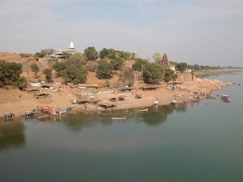
Nemawar is a small town in Dewas District, Madhya Pradesh, India. Handia is located on the left bank of the Narmada river opposite side to Handiya. However, it belongs to Khategaon block and tehsil of the Dewas district
Contents
Map of Nemawar, Madhya Pradesh 455339
Nemawar is a holy place for both Hindus and Digambara sect of Jains. Pilgrims on Narmada Parikrama often visit this place.
Location
Nemawar is 128 km from Indore, on National Highway 59A.
Demographics
Nemawar is a village with total 1241 families residing. The Nemawar has population of 5978 of which 3131 are males while 2847 are females as per Population Census 2011. In Nemawar village population of children with age 0-6 is 848 which makes up 14.19% of total population of village. Average Sex Ratio of Nemawar village is 909 which is lower than Madhya Pradesh state average of 931. Child Sex Ratio for the Nemawar as per census is 884, lower than Madhya Pradesh average of 918.
Nemawar village has higher literacy rate compared to Madhya Pradesh. In 2011, literacy rate of Nemawar village was 74.15% compared to 69.32% of Madhya Pradesh. In Nemawar Male literacy stands at 82.51% while female literacy rate was 65.01%.
As per constitution of India and Panchyati Raaj Act, Nemawar village is administrated by Sarpanch (Head of Village) who is elected representative of village.
History
Nemawar was ruled by Rege (Sarmandal) from 1765 to 1947, as they were Jahagirdars of Holkars of Indore. Prabhakarrao Sarmandal was the last ruler till 1947 and Ramchanchandrarao was first from around 1765.
Places of interest
Important places to see in Nemawar:
