
Pop. density 0.54 /km (1.4 /sq mi) Max length 67.6 km | Population 1197 (2010) Area 2,183 km² Max width 56.3 km | |
 | ||
Nelson Island (Qaluyaaq in Central Yup'ik) is an island in the Bethel Census Area of southwestern Alaska. It is 42 miles (68 km) long and 20–35 miles (32–56 km) wide. With an area of 843 square miles (2,183 km²), it is the 15th largest island in the United States. It is separated from the Alaska mainland to its north by the Ningaluk River, to its east by the Kolavinarak River and from Nunivak Island to its southwest by the Etolin Strait.
Map of Nelson Island, Alaska, USA
Nelson Island has three villages, all located on the Bering Sea coast in the southwest part of the island: Tununak in the west, Toksook Bay Which includes a bedroom Type Suburban neighborhood called Umkumiut In Toksook bays's city limits. southeast of Tununak, and thirdly Nightmute in the farther east near the edge of the Island.
A snowmobile trail connects the Tununak and Nightmute in the winter. These three communities comprise the entire population of the island at 1,065 inhabitants as of the 2000 census. The largest community is Toksook Bay. The rest of the island, over 77 percent of its area, is unpopulated.
The village of Newtok, on the mainland across the Ningaluk River north of the island, is in the process of being moved to Nelson Island, due to erosion of the water table in the area where Newtok is currently located.
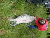
The natives are Yupiit who maintain a predominately traditional diet, fishing and hunting musk ox and caribou.
Nelson Island was named after Edward William Nelson, a Smithsonian Institution naturalist who studied the island and people there in 1878.