
Airport type Public Elevation AMSL 983 ft / 300 m 2/20 4,235 Elevation 300 m | Website www.sbcounty.gov/... 4,235 1,291 Phone +1 760-326-5263 | |
 | ||
Address 711 Airport Rd, Needles, CA 92363, USA Owner San Bernardino County, California | ||
Needles Airport (IATA: EED, ICAO: KEED, FAA LID: EED) is a county-owned public airport in San Bernardino County, California, five miles (9 km) south of Needles.
It opened in May 1941. During World War II the airfield was known as Needles Army Airfield and was used by the United States Army Air Forces Fourth Air Force. With the end of the war the base returned to civil control.
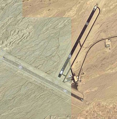
Facilities and aircraft
Needles Airport covers 796 acres (322 ha) at an elevation of 983 feet (300 m) above mean sea level. It has two asphalt runways: 2/20 is 4,235 by 100 feet (1,291 x 30 m) and 11/29 is 5,005 by 100 feet.
In the year ending February 17, 2006 the airport had 10,500 general aviation aircraft operations, an average of 28 per day. 8 aircraft were then based at this airport: 62.5% single-engine and 37.5% ultralight.