
Elevation 251 m | ||
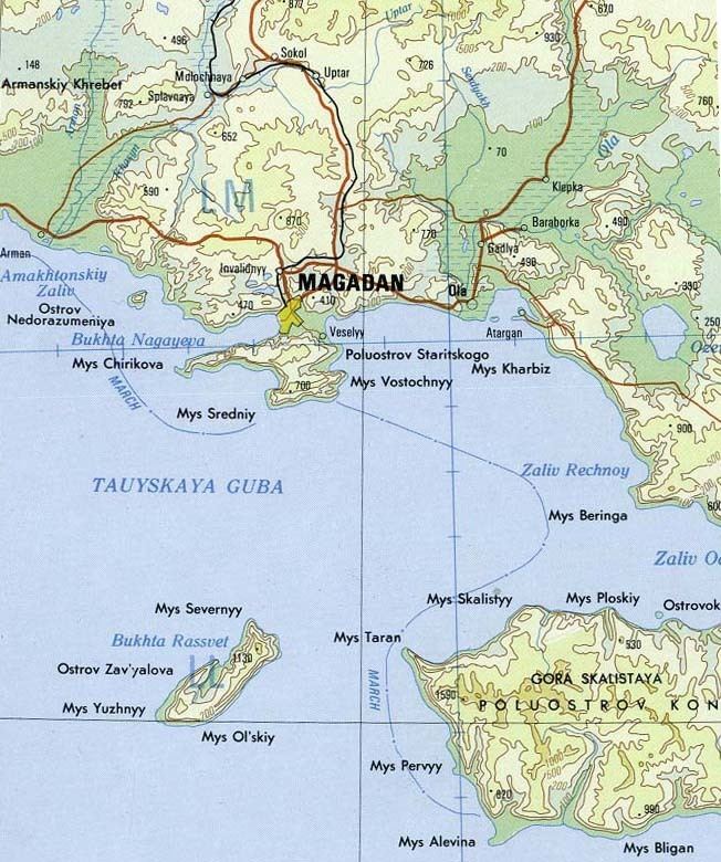 | ||
Nedorazumeniya Island (Russian: Остров Недоразумения - Ostrov Nedorazumeniya; literally Island of misunderstanding) is an island on the north coast of the Sea of Okhotsk. It lies on the north side of Taui Bay, between Amakhton Bay to the west and Nagaev Bay to the east. It is about 20 kilometres (12 mi) west of the city of Magadan.
Contents
Map of Nedorazumeniya Island, Magadan Oblast, Russia, 685930
Nedorazumeniya Island lies 3 kilometres (1.9 mi) off the coast and is roughly triangular in shape. It is 3.5 kilometres (2.2 mi) long and has a maximum width of about 2 kilometres (1.2 mi).
On Nedorazumeniya's northeastern headland there is a settlement called Ribachiy.
Administratively Nedorazumeniya Island belongs to the Magadan Oblast of the Russian Federation.
Etymology
The name of the island is remarkable. "Nedorazumeniye" in Russian means "misunderstanding", "error". The island got such a strange name because it was originally not mapped by a Russian expedition in the 1910s. Then the mistake was identified and corrected.
History
Between 1853 and 1868, American and Russian whaleships anchored between Nedorazumeniya Island and the mainland to obtain shelter from storms, procure wood and water from the island, flense whales, or boil oil. They called the island Fabius Island, while the anchorage was called Fabius Harbor. Both features are named after the ship Fabius (432 tons), of New Bedford, which frequented Taui Bay in the early 1850s. A graveyard existed on the north side of the island. Boats also spent the night on the island after cruising for bowhead whales all day.