
Existed: 1933 – present Constructed 1933 | Length 24.51 km | |
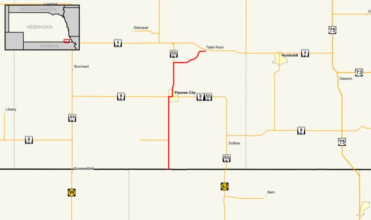 | ||
South end: Bailey-Pawnee Road at Kansas border south of Pawnee City | ||
Nebraska Highway 65 is a highway in southeastern Nebraska. It is a north–south highway with a length of 15.25 miles (24.54 km). The southern terminus of Nebraska Highway 65 is at the Kansas border south of Pawnee City. The northern terminus is in Table Rock at an intersection with Nebraska Highway 4.
Contents
Route description
Nebraska Highway 65 begins at the Kansas border. The road continues into Kansas as Bailey-Pawnee Road. Highway 65 goes north from the border on a gravel road. The highway becomes paved as it approaches Pawnee City. It then meets Nebraska Highway 8 at the western city limits of Pawnee City and they run concurrently going east until an intersection with Nebraska Highway 50. Highway 65 then turns north with Highway 50 and they run concurrently for 3 miles (4.8 km). They then separate and Highway 65 goes east, then northeast and ends in Table Rock at an intersection with Nebraska Highway 4.
Major intersections
The entire route is in Pawnee County.