
Existed: 1933 – present Length 67.67 km | Constructed 1933 | |
 | ||
North end: N-14 southeast of Albion Counties Polk County, Nebraska, Merrick County, Nebraska | ||
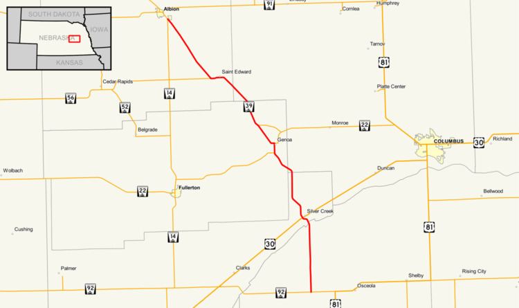
Nebraska Highway 39 is a highway in central Nebraska. It runs for a length of 42.05 miles (67.67 km). It has a southern terminus west of Osceola at an intersection with Nebraska Highway 92. Its northern terminus is at an intersection with Nebraska Highway 14 southeast of Albion.
Route description
Nebraska Highway 39 begins in rural Polk County west of Osceola at Nebraska Highway 92. It goes north through farmland, crosses the Platte River and meets U.S. Highway 30 at Silver Creek. It runs northwesterly and crosses over the Loup River shortly before meeting Nebraska Highway 22. NE 39 and NE 22 then overlap into Genoa. They separate and NE 39 continues northwest into St. Edward. It goes west out of St. Edward and at an intersection with Nebraska Highway 56, turns northwest again. Shortly before Albion, the highway meets Nebraska Highway 14 and ends.