
Elevation 1,190 m | Time zone EAT (UTC+3) Local time Thursday 6:54 AM | |
 | ||
Weather 19°C, Wind S at 6 km/h, 93% Humidity | ||
Uba uganda shuts down ndeeba branch
Ndeeba is a neighborhood in the city of Kampala, Uganda's capital.
Contents
- Uba uganda shuts down ndeeba branch
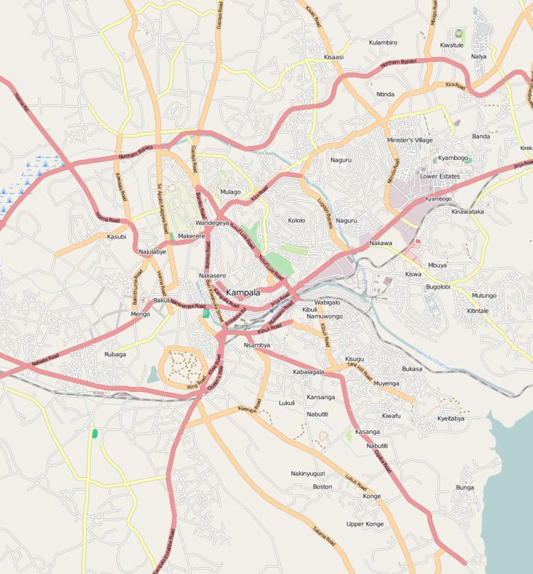
- Map of Ndeeba Kampala Uganda
- Location
- Overview
- Points of interest
- References
Map of Ndeeba, Kampala, Uganda
Location
Ndeeba is located in Lubaga Division, one of the five administrative divisions of Kampala. It lies on the southern edge of the city. It is bordered by Mengo to the north, Katwe to the northeast, Kibuye to the east, Makindye and Najjanankumbi to the southeast, Kabowa to the south, Mutundwe to the west and Lubaga to the northwest. The road distance between Kampala's central business district and Ndeeba is approximately 5 kilometres (3.1 mi). The coordinates of Ndeeba are:0°17'24.0"N, 32°33'54.0"E (Latitude:0.2900; Longitude:32.5650).
Overview
Ndeeba lies on the main highway (A-109), between Kampala and Masaka. It was a trading center and a lower middle-class residential area in the 1950s and 1960s. Today, Ndeeba has morphed into a busy metropolitan area with businesses, small industries, retail shops and a thriving farmers market. Many of the leading financial houses in Uganda maintain branches in the area due to the booming business in commercial and retail banking in the neighborhood. Behind the thriving business environment along the main road, lies a sprawling slum with all the challenges that come with crowded, poor, urban living.
Points of interest
The following points of interest lie in or near Ndeeba: