
Country Area 27,857 km2 Governor Roberto Sandoval | Capital Population 1.085 million (2010) | |
 | ||
Destinations | ||
University Autonomous University of Nayarit | ||
Map of Nayarit
Nayarit ([naʝaˈɾit]), officially the Free and Sovereign State of Nayarit (Spanish: Estado Libre y Soberano de Nayarit), is one of the 31 states which, with the Federal District, make up the 32 federal entities of Mexico. It is divided in 20 municipalities and its capital city is Tepic.
Contents
- Map of Nayarit
- Marival resort and suites nuevo vallarta riviera nayarit mexico best travel destination
- Mexico surf vacations in riviera nayarit rancho escondido
- History
- Geography
- Municipalities
- Environment
- Flora and fauna
- Education
- Demographics
- Indigenous groups
- Economy
- Good food great vibe nice companies sanpancho nayarit mexico camping roadtrip
- Grand velas riviera nayarit mexicos top foodie resort
- References

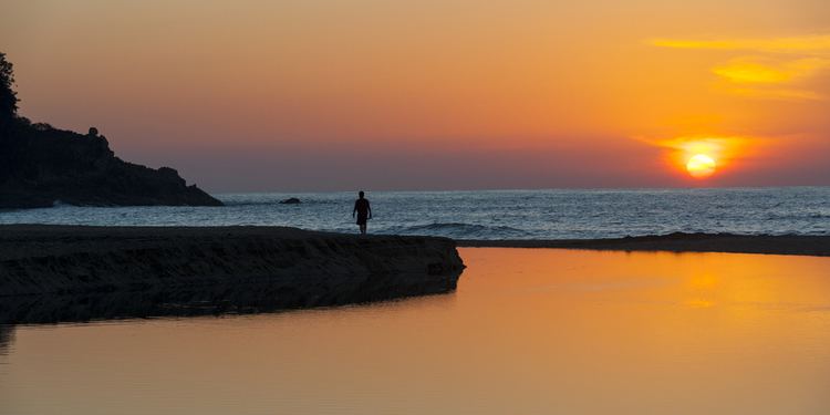
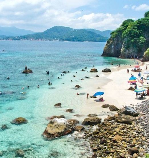
It is bordered by the states of Sinaloa to the northwest, Durango to the north, Zacatecas to the northeast and Jalisco to the south. To the west, Nayarit has a significant share of coastline on the Pacific Ocean, including the islands of Marías and Marietas. The beaches of San Blas and the so-called "Riviera Nayarit" are popular with tourists. Beside tourism, the economy of the state is based mainly on agriculture and fishing.
Home to Uto-Aztecan indigenous peoples such as the Huichol and Cora, the region was exposed to the conquistadores, Hernán Cortés and Nuño de Guzmán, in the 16th century. Spanish governance was made difficult by indigenous rebellions and by the inhospitable terrain of the Sierra del Nayar. The last independent Cora communities were subjugated in 1722. The state's name recalls the Cora's label for themselves: Náayerite, commemorating Nayar, a resistance leader.
Marival resort and suites nuevo vallarta riviera nayarit mexico best travel destination
Mexico surf vacations in riviera nayarit rancho escondido
History
Radiocarbon dating estimate Aztatlán colonization of the western Mexican coast – including parts of Sinaloa, Nayarit and Jalisco – as occurring as early as 900 AD, with some evidence suggesting it might have been as early as 520 AD. Encountered on the western coast by the Spanish invaders in 1500, the cultures were descended from these original Aztatlán settlements and other Classic stage cultures who had merged with them.
Hernándo was the first known European to enter into the area now known as Nayarit, which claimed for Spain as part of the colony of Nueva Galicia. As the Spaniards invaded the area, led by Nuño de Guzman, their brutality caused the indigenous inhabitants to revolt, in what was later referred to as the Mixtón War. After almost two centuries of resistance, the last independent Cora communities were incorporated into the colonial administration by force in 1722. Then followed intense missionary efforts by Jesuit friars.
In the colonial period, the port of San Blas was one of the most important trade ports on the American Pacific coast. Galleons transporting goods from Manila, the Philippines arrived here before the rise of the port of Acapulco. Today, the town still boasts colonial architecture from the its heyday, such as the aduana (customs office), contaduria (accounting offices) and the fortress that protected the port against pirates.
In Nayarit, the struggle for independence from Spain was initiated by the priest José María Mercado, who conquered Tepic and San Blas before being defeated and executed by Spanish royalists. With the first independent constitution of 1824, Nayarit was a part of Jalisco state. During the second half of the 19th century, Nayarit was one of the most turbulent territories in Mexico. The population was in open revolt, demanding access to land. Nayarit was one of the last territories admitted as a state of the Mexican federation, which occurred on May 1, 1917.
Geography
Nayarit covers 27,815 square kilometers (10,739 sq mi), making it one of the smaller states in Mexico. Nayarit is located between latitude lines 23°05' north and 20°36' south and longitude lines 103°43' east and 105°46' west. Its terrain is broken up by the western ends of the Sierra Madre Occidental mountains. Its highest mountains are: San Juan, Sanguangüey, El Ceboruco, Cumbre de Pajaritos and Picachos. Nayarit has two volcanoes, Ceboruco and Sangangüey. In the northeast are broad, tropical plains watered by the Río Grande de Santiago, a continuation of the Lerma River. The main state rivers are the Río Grande de Santiago, San Pedro, Acaponeta, Ameca and Las Cañas. The Río Grande de Santiago is the largest river in Nayarit. The Santiago and its tributaries are of major importance for agricultural irrigation. The Ameca and the Las Cañas lie on the border between Nayarit and the states of Jalisco and Sinaloa, respectively. Notable lagoons in Nayarit include Santa María del Oro, San Pedro Lagunillas and Agua Brava.
Municipalities
Nayarit – as all states of Mexico – is geographically divided into municipalities (municipios), creating twenty municipalities in Nayarit:
Environment
Nayarit contains hundreds of miles of rain forest in the sierra. Its wildlife includes hundreds of bird species including the lilac-crowned amazon (Amazona finschi) and Mexican woodnymph (Thalurania ridgwayi). There are also registered 119 species of mammals, including white-tailed deer (Odocoileus virginianus), collared peccary (Pecari tajacu), caymans, armadillos and wild felines such as jaguarundi (Puma yagouarundi) and ocelot (Felis pardalis) and many more. Unfortunately, most of the rain forest has been exploited, especially around the region of Santa María del Oro. The conservation and protection of the rain forest and wildlife of Nayarit is an issue of crucial importance.
The Islas Marías were designated as the Islas Marías Biosphere Reserve by UNESCO in 2010.
Flora and fauna
Note: The animal list has left out the iguana very distinguishable in the San Blas area; fish, oysters, and many other animals from the local river are also missing.
Education
Demographics
Nayarit is Mexico's twenty-ninth most populous state. According to the census of 2010, the state had a population of 1,084,979 and its population density was 39/km2.
Indigenous groups
Nayarit is the home to four indigenous groups: the Wixaritari (Huichol), the Naayeri (Cora), the Odam (Tepehuan) and the Nahuatl-speaking Mexicaneros. The indigenous groups mostly inhabit the Nayar highlands, but are also frequently encountered in Tepic and on the Pacific coast, where they have also established colonies. They are known for their crafts and artwork which they sell. About 5% of the population of the state population speak an indigenous language.
Economy
Nayarit is predominantly an agricultural state, and produces a large variety of crops such as beans, sorghum, sugar cane, corn, tobacco, rice, chiles, peanuts, melons, tomatoes, coffee, mangoes, bananas, and avocados. In addition to these crops, livestock and fishing are also central to the local economy. Approximately 6 percent of the land in Nayarit is pasturelands, with the most common livestock being cattle, horse, pigs, goats, and sheep. Nayarit has 289 kilometers of coastline, which provides an abundance of fish and shellfish, including bass, snapper, sharks, and oysters. There are over 75 cooperatives related to the fishing industry alone in Nayarit. Much of the food produced in Nayarit is exported to the larger urban areas surrounding Mexico City and Guadalajara, and much of the agricultural labor is performed by migrant laborers. There is some mining in Nayarit, but it is mostly of non-metallic substances such as limestone or kaolin.
In recent years, Nayarit has worked to build its tourism sector, marketing the "Riviera Nayarita" as a safe, beautiful destination served by Puerto Vallarta International Airport. Popular resort towns include San Blas, Santiago Ixcuintla, Tecuala, and Compostela. However, some residents in these and other towns are concerned that the growth in the tourism industry might have harmful impacts on the community. Due to the tourism growth, a lot of residents in the community have fallen victim to timeshare scams.