
Country Mexico Area 123,317 km2 Governor Jorge Herrera | University Fort Lewis College Capital Victoria de Durango Population 1.633 million (2010) | |
 | ||
Map of Durango
Durango ( duˈɾaŋɡo ), officially Free and Sovereign State of Durango (Spanish: Estado Libre y Soberano de Durango) (Tepehuan: Korian) (Nahuatl: Tepēhuahcān), is a Mexican state. The state is located in Northwest Mexico. With a population of 1,632,934, Durango has Mexico's second-lowest population density, after Baja California Sur. The city of Victoria de Durango is the state's capital, named after the first president of Mexico, Guadalupe Victoria.
Contents
- Map of Durango
- Durango best place to live
- Pre colonization
- Spanish colonization
- Comanche raids
- War 1820s
- Confrontations 1834 1853
- Geography
- Cinema
- Cuisine
- Economy
- Ecotourism
- Demographics
- Mennonites
- Indigenous peoples
- Municipalities
- Major communities
- Notables
- Popular culture
- References

Durango best place to live
Pre-colonization

Durango, along with the states of Chihuahua, Sonora and Sinaloa, formed the historical and geographical center of Northern Mexico, for what was the majority of the last millennium. When the territories were reorganized after the independence struggle, they emerged as independent entities. This broad area represents the natural corridor that the Sierra Madre Occidental offered to the Toltec and Nahuatlaca tribes, who took advantage of the large accidental stone conformations to survive in the wilderness. The new formations formed as the only security for the tribes that moved among Northern Mexico and the Valley of Anahuac, eventually becoming a home-state for these tribes who then began to form small communities, united by language and region. The Tepehuános, Huichol, Cora, Tarahumara were distinct nations, each intending to amidst a strong family structure. They avoided the bellicose attitude of the Chichimec tribe of the center of the then-current Republic. Settled life began in Durango around 500 B.C. in response to population growth. The exceptions were the Acaxee, Humas and Xiximes who were constantly at war, but always on the lookout for final settlements in the region of the Quebradas.

On the east bank of the state a longitudinal zone can be found that extends from the current state of Zacatecas to the la Laguna area between Durango and Coahuila. The "Indios Laguneros" (Laguna Indians) traveled interchangeably between this area. They were characterized by their rebellious attitude, instability, religious customs and as hunters and gatherers. Little was recorded of these natives who were the first inhabitants of the region, long before they were exterminated by the Spanish colonists. Today, only a few remain of the Tepehuanos, Huicholes, Coras and Tarahumara tribes.
By around 200–300 A.D., Durango (along with the north central zone from the Bajio to the states of Durango, Zacatecas, and San Luis Potosí) was inhabited by settled groups that linked to cultures located further south. The state was connected by a broad commercial network that linked it to areas as north as far New Mexico and as far south as the valley of Mexico.
Spanish colonization
Once the province of New Spain was established in the rest of the country, Spanish explorers ventured out to conquer Northern Mexico, establishing the province of Nueva Vizcaya, in honor of the Spanish province of the same name. Spanish explorer Captain Francisco de Ibarra, the first to colonize Durango, settled this part of the northern province of Nueva Vizcaya. On July 8, 1563, he founded the capital city and named it Durango for the town of Durango, Biscay, Spain. Durango, along with Chihuahua, Sonora and Sinaloa, formed part of the province of Nueva Vizcaya, a name that was used during the colonial period to designate the territory discovered by de Ibarra between 1554 and 1567.
Several important factors contributed to the name; one was that iron mines found in Durango also existed in Biscay, which gave more meaning to the name. Additionally many of the soldiers who came on the de Barra expedition were Basques. .
In 1552 Spanish Captain Ginés Vázquez del Mercado discovered one of the world's richest iron-ore deposits (now an important part of Durango) which was named after him, present-day Cerro de Mercado. Gradually, in the following decades, the Franciscans and then the Jesuits began to evangelize Nueva Vizcaya, laying the foundations of a large diocese. The towns Nombre de Dios, Peñol (Peñón Blanco), San Juan Bautista del Río, Analco, Indé, Topia, La Sauceda, Cuencamé and Mezquital arose from the evangelical work of the Franciscan order. Mapimi, Santiago Papasquiaro, Tepehuanes, Guanacevi, Santa Maria del Oro, Tamazula, Cerro Gordo (Villa Ocampo), San Juan de Bocas (Villa Hidalgo) and two establishments originally belonged to the Franciscans. La Sauceda (Canatlan) and Cuencame, were established by the Society of Jesus at the invitation of Spanish Governor Rodrigo del Río de Lossa.
The establishment of garrisons in Northern Mexico provided security to the people. New routes joined the military camps and thus emerged the 'Courier of the Provinces', a government scheme adopted by the Spanish in 1767. The new territory began to split in the colonial period. The first to emerge was Sinaloa Province, which then included the areas known today as Sonora and Arizona. Later, the state of Coahuila separated, and with the Constitution of 1824, was divided into provinces, creating the states of Durango and Chihuahua, and attaching some municipalities to the state of Zacatecas.
Durango did not escape the great national struggle between conservatives and liberals and the capital was taken several times by representatives of both sides, as was the case of siege imposed by Coronado and Patoni in 1858 for the liberal cause, as well as the French intervention between 1864 and 1866 that occupied the state with the support of conservative forces. At the time that Porfirio Díaz was the head of the Republic. Durango also experienced local dictatorships such as that of Governor Juan Manuel Flores, who held office between 1884 and 1897. Esteban Fernandez, who also became governor, was reelected in 1908 after his four-year term only to leave in 1911.
During the Porfiriato (reign of Porfirio Díaz), Durango joined the network of railway and telegraph networks that he laid down, creating new regions, as was the case of the Laguna region from which the cities of Lerdo and Gomez Palacio emerged. The railroad connected the state capital with Mexico City and the border towns, which allowed the marketing of goods produced in the region, and the transportation of mineral resources for export.
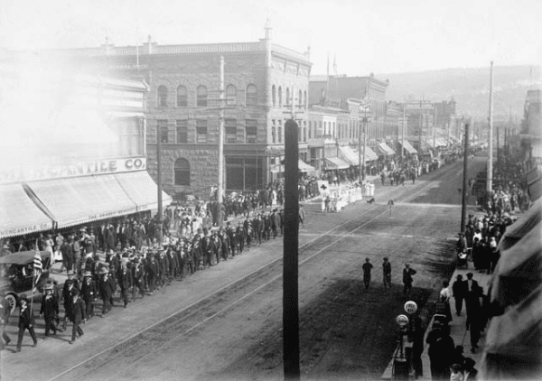
Durango played an important role in the Mexican Revolution. Important revolutionary figures fought important battles between 1910 and 1924, including Francisco Villa, Calixto Contreras and Severino Cenicero, in support of the "Maderistas", supporters of the ideologies of President Francisco I. Madero. On November 21, 1910, Duranguense military personnel Jesús Agustín Castro and Oreste Pereyra, took up arms in the Laguna region commanding a small army that joined the forces of Francisco I. Madero, shortly after his assassination.
The splitting of the territories continued with the government of Enrique R. Calderon, who implemented the policies of President Lázaro Cárdenas with the distribution of 100,000 acres (400 km2) in the Laguna region and the formation of the Municipality of Tlahualilo, shedding Mapimí and Gomez Palacio. At the half century, the "educational crusade" began that created colleges such as Instituto Tecnológico de Durango (Technological Institute of Durango) and Universidad Juarez del Estado de Durango (University of Juarez in Durango). The latter was based on the historical Instituto Juarez (Juarez Institute), which dates to the eighteenth century. At that time, the town of Vicente Guerrero emerged, separating itself from Suchil an action that resulted in the geographical completion of the state of Durango, with modern means of communication in the form of paved roads that connected the municipalities with the capital.
Later a rural exodus to the cities, requiring many development services that completely changed the traditional image of Colonial and Porfirista Durango. This was a late colonization for the Spanish, due mostly to heavy resistance by the indigenous population. From first contact, the indigenous peoples have attempted to gain autonomy, address grievances and maintain traditional land ownership. Spanish colonists became highly attracted to the Durango area for its mining and grazing prospects. In 1823, shortly after victory over Spain in the Mexican War of Independence, Durango became a separate state.
Comanche raids
The Comanche Indians had begun raiding Spanish settlements in Texas as early as the 1760s. Soon after, Comanche warriors began raiding Chihuahua, Sonora, Coahuila, Durango and Nuevo León. T. R. Fehrenbach wrote that "a long terror descended over the entire frontier, because Spanish organization and institutions were totally unable to cope with war parties of long-striking, swiftly moving Comanches." Mounting extended campaigns into Spanish territory, the Comanches avoided forts and armies. Fehrenbach states that these Amerindians were "eternally poised for war." They traveled across great distances and struck their victims with great speed. "They rampaged across mountains and deserts," writes Mr. Fehrenbach, "scattering to avoid detection surrounding peaceful villages of peasants for dawn raids. They waylaid travelers, ravaged isolated ranches, destroyed whole villages along with their inhabitants."
War (1820s)
In the 1820s, the newly independent Mexican Republic was so preoccupied with political problems that it failed to adequately defend its northern territories. Comanches ended the peace that they had made with the Spaniards and resumed warfare against the Mexican Federal Government. By 1825, they were making raids deep in Texas, New Mexico, Coahuila, Nuevo León, Chihuahua and Durango.
"Such conditions were permitted to continue in the north," writes Mr. Fehrenbach, "because independent Mexico was not a homogeneous or cohesive, nation it never possessed a government stable or powerful enough to mount sustained campaigns against the Amerindians." As a result, Comanche raiders killed thousands of Mexican soldiers, ranchers and peasants south of the Rio Grande.
Confrontations (1834-1853)
In 1834, Mexico signed its third peace treaty with the Comanches of Texas. However, almost immediately Mexico violated the peace treaty and the Comanches resumed their raids in Texas and Chihuahua. In the following year, Sonora, Chihuahua and Durango reestablished bounties for Comanche scalps. Between 1848 and 1853, Mexico filed 366 separate claims for Comanche and Apache raids originating north of the Mexico–US border.
A 1849 government report claimed that twenty-six mines, thirty haciendas, and ninety ranches in Sonora had been abandoned or depopulated between 1831 and 1849 because of Apache depredations. In 1852, Comanches raided Coahuila, Chihuahua, Sonora, and Durango and even Tepic in Jalisco (now in Nayarit), approximately 700 miles south of the United States-Mexican border.
Geography
Durango is the fourth largest state in Mexico. The state is bordered to the north by Chihuahua, to the northeast by Coahuila, to the southeast by Zacatecas, to the southwest by Nayarit, and to the west by Sinaloa.
With an average elevation of almost 2,000 metres (6,600 ft), most of the state is mountainous and forested. The Sierra Madre Occidental occupies two-thirds of the state, mostly in the western and central part. In the western parts of the Sierra Madre, the geography is characterized by deep ravines and rivers that mostly flow westward. The highest point in the state is Cerro Gordo at 3,340 m (10,960 ft) above sea level. This mountain range contains minerals, including the silver that encouraged Spanish occupation. These mines extend north into Chihuahua and south into the state of Zacatecas. Vast desert basins in the Laguna District are irrigated by the Nazas River.
In summer, the average maximum temperature range is from 35.0 °C (95.0 °F) in the eastern parts of the state to a low of 20.0 °C (68.0 °F) in the western parts. In winter, the max ranges from 15.0 °C (59.0 °F) to a low of 0 °C (32.0 °F) in the winter. Except for the mountainous areas and small lowland areas in the west such the Quebradas area, the state is fairly dry because the Sierra Madre blocks most of the humid air coming in from the Pacific coast.
The climate in the mountains tends to be cool with snowfalls common in winter and heavier precipitation in the summer than the rest of the state. However, the snow that falls does not linger. The average temperature reaches a maximum of 16.0 °C (60.8 °F) in June in the Sierra Madre. Precipitation is highly seasonal with 70-80% falling from June to September. East of the Sierra Madre, the climate is drier and warmer and precipitation is just enough to support agriculture. Most of the precipitation falls during the summer months, owing to the monsoon in southern Mexico that moves northward to reach the northern states and parts of the US by July. Drought-like conditions and extreme temperature changes are common in the central parts. Owing to the contrast in climatic conditions, between January and April, the state has strong winds that run from the southeast. The average precipitation in the state varies from a low of 273 millimetres (11 in) in Ciudad Lerdo in the far-eastern part of the state to 890 millimetres (35 in) in El Salto in the west.
Cinema
Durango is known nationally and even internationally as "the land of the scorpions" and as "the land of cinema". Durango has hosted over 120 film productions, both domestic and foreign.
Film arrived in a train heading to Durango in 1889. When the Mexican Revolution began in 1910, film producer Raoul Walsh recorded the battles of General Francisco Villa. These scenes were included in the film The Life of General Villa produced by D. W. Griffith, and directed by Christy Cabanne in 1914. Hollywood discovered Durango in the mid-century.
In 1954, the film industry officially entered the state; American film art director Jack Smith was enthralled by the landscape. The first movie filmed in Durango was White Feather, directed by Robert D. Webb. Durango had close ties with John Wayne, an American actor and icon of Western movies. The close friendship between Durango and Wayne started in 1965 and resulted in the films The Sons of Katie Elder, The War Wagon and Chisum, among many others. Wayne even acquired a ranch in the state.
Cuisine
The Spanish brought their recipes and the first ungulate herds. Among the dishes is "caldillo", particularly noted for its antiquity. Along with beef it can be prepared with chile verde (green chile), chile Colorado (red chile), or chile pasado (dehydrated green chiles). The broth was the state's first culinary preparation, and demonstrates the influence of cultures that were part of the genesis of Durango. Its origin dates to the days of de Ibarra. The oldest surviing written mention is in a manuscript that belonged to Joseph del Campo Soberón and Larrea Soberon, the Count of Súchil Valley.
Durango is known for its marmalades and preserves made from quince, figs and peaches, as well as the native pitahaya..Gallina Borracha or 'drunken chicken' is a dish unique to Durango, made mostly of Spanish ingredients, such as raisins, sherry and almonds. Traditional drinks include Licor de Membrillo, a liquor made from quince. Durango is known for its cheese, in particular queso chihuahua, also called 'queso menonita', a type of cheese made by Mennonite residents as well as the traditional ""Queso Ranchero"" usually made in the high Sierra's (mountains) of Durango . Another plate unique to Durango (usually more to North Western Durango) is Venorio, made with pork ribs cut into pieces, nopales (cactus) and a special chile sauce made with different ground seeds of pumpkin as well as chile seeds, and has a distinctive orange look to the sauce. Carne seca (beef jerky) is another traditional food that can be used to make ""machaca con huevo" (jerkey with eggs) and caldillo con papas (jerkey with potato soup). Duranguense enjoy traditional Mexican dishes, such as tamales, tacos, cabrito and enchiladas.
Economy
Major crops grown in the area include cotton, wheat, corn, alfalfa, beans, sorghum, and other vegetables.
Durango is famous for its scorpions. The scorpion is a common symbol representing the state. Mexicans generally refer to the people of Durango as Alacrán de Durango (Scorpions from Durango). The demonym for the natives of Durango is Duranguense(s).
The major occupations in Durango are farming, logging, mining, and ranching.
Ecotourism
Durango's geographical diversity allows sports enthusiasts to participate in extreme sports such as kayaking, mountain biking, abseiling, free climbing and more; Durango is also home to many gorges, and voluminous waterfalls that measure 80 feet (24 m) one of which is Salto del Agua LLovida. The state also has numerous lakes that measure over 800 meters in diameter such as Lago de Puentecillas (Puentecillas Lake).
Demographics
According to the 2005 census, Durango had just over 1.5 million inhabitants, 24th within the 32 federal entities, and reports an average growth rate so low that it would take more than 250 years to double its numbers.
90% of the population are baptized Catholics who are mostly concentrated in rural areas. Urban areas contain significant religious minorities consisting of Protestants, Orthodox Christians, Ashkenazim Jews, Muslims, Atheists and Buddhists.
Population density is only 12 inhabitants per km2. 60% of the population is concentrated in three of the 39 state municipalities: Durango, Gómez Palacio and Lerdo. The rest live in small and disperse locales. As many as 6,258 communities fill the state, 82% of which have fewer than 100 inhabitants.
Some 67% of the population lives in urban areas, below the 76% national average. Even so, the migration of people from the rural zones towards urban environments represents a complex issue for the government, because it implies satisfying a high demand for urban public services and utilities.
Mennonites
Mennonites are another important ethnic group residing in the state for nearly a century. Roughly 20,000 German-speaking Mennonites reside in secluded communities throughout the semi-arid region of the state.
Indigenous peoples
Of the 65 ethnic groups that exist in Mexico, five coexist in Durango territory: Tepehuanes or O'dam, Mexicaneros or Nahuatl, Huichol, Cora and Tarahumara or Rarámuris. At least 2% of the population over 5 years of age speak an indigenous language, 80% of which belong to the Tepehuan ethnic group, which is indigenous to the state. Other smaller indigenous groups include the Huichol and the Mexicaneros, the latter of unknown descent who speak a variety of Nahuatl. The indigenous population is approximately 29 thousand people: the majority is Tepehuano followed by the Huichol, Cora, Los Mexicaneros Nahuatl and the Tarahumara, each at less than 10%.
Municipalities
Durango is divided into (39 municipalities).
Major communities
Source: INEGI
Notables
Popular culture
Bob Dylan's song, "Romance in Durango", is on his Desire 1976 album. Also famous is Fabrizio De Andrè's "Avventura a Durango", an Italian version of "Romance in Durango".
The Champs released the song "The Man From Durango" on their album Wing Ding in 1993.