
 | ||
This is the list of the National Register of Historic Places listings in Rensselaer County, New York. It is intended to be a complete compilation of properties and districts listed on the National Register of Historic Places in Rensselaer County, New York, United States. The locations of National Register properties and districts (at least for all showing latitude and longitude coordinates below) may be seen in a map by clicking on "Map of all coordinates". Seven of the properties are further designated National Historic Landmarks.
Rensselaer County sits east of the Hudson River in New York's Capital District and borders both Massachusetts and Vermont on the east. The area was originally inhabited by the Mohican Indian tribe until it was bought by the Dutch jeweler and merchant Kiliaen van Rensselaer in 1630 and incorporated in his patroonship Rensselaerswyck (which, in turn, was part of the Dutch colony New Netherland). The land passed into English hands in 1664 until the Dutch regained control for a year in 1673, but the English took it back in 1674. Until 1776, the year of American independence, it was under English or British control. However, the county didn't actually exist as a legal entity until 1791 when it was created from land that was originally part of Albany County.
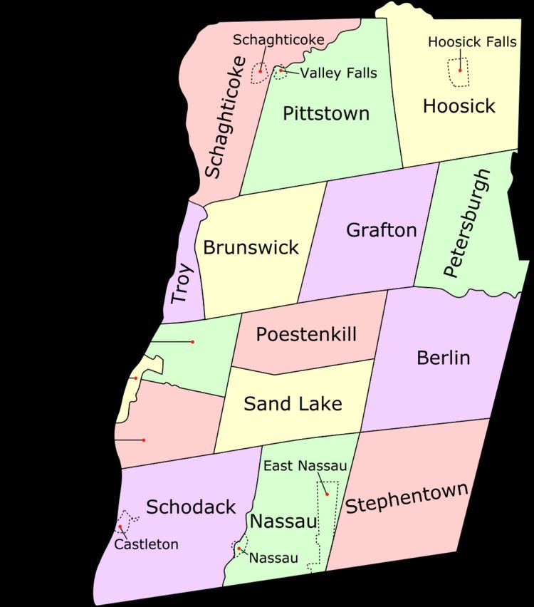
Rensselaer County consists of two cities: Rensselaer and Troy; and fourteen towns: Berlin, Brunswick, East Greenbush, Grafton, Hoosick, Nassau, North Greenbush, Petersburgh, Pittstown, Poestenkill, Sand Lake, Schaghticoke, Schodack, and Stephentown; and contains six villages: Castleton, East Nassau, Hoosick Falls, Nassau, Schaghticoke, and Valley Falls.