
Country United States Elevation 594 ft (181 m) Area code(s) 812 Zip code 47448 | Time zone Eastern (EST) (UTC-5) FIPS code 18-52038 Local time Monday 10:57 PM | |
 | ||
Weather 11°C, Wind NE at 8 km/h, 81% Humidity Points of interest Brown County State Park, Brown County Art Guild, Nashville Express Train Tours | ||
8650 mt nebo road freetown in 47235 real estate for sale near nashville indiana
Nashville is a town in Washington Township, Brown County, Indiana, United States. The population was 803 at the 2010 census. The town is the county seat of Brown County and is the county's only incorporated town. The town is best known as the center of the Brown County Art Colony and as a tourist destination.
Contents
- 8650 mt nebo road freetown in 47235 real estate for sale near nashville indiana
- Map of Nashville IN 47448 USA
- History
- Tourism
- Geography
- Climate
- 2000 census
- 2010 census
- Trivia
- Nearby points of interest
- References
Map of Nashville, IN 47448, USA
History
Settlement of land in and around Nashville began with the acquisition of land from native populations under the 1809 Treaty of Fort Wayne. This was expanded with more acquisitions under the 1818 Treaty of St. Mary's. Founded in 1836 by county agent Banner C. Brummett, it was first named Jacksonburg. The population of the entire county was estimated to be 150 in 1830. The first Nashville courthouse was constructed in 1837 and a jail was added in the same year. By 1840, area population had grown to 2,364. The town was officially incorporated in 1872. By the turn of the century, heavy logging in the area had caused significant deforestation which resulted in dramatic erosion problems.
In the early twentieth century, a number of artists settled in the area, most notably T. C. Steele, the American Impressionist painter. These artists were the basis for the Brown County Art Colony, which continues to this day as the Brown County Art Guild.
The Brown County Courthouse Historic District and F.P. Taggart Store are listed on the National Register of Historic Places.
Tourism
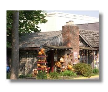
Today, Nashville boasts a tourist industry based upon the original works of resident artists and upon the area's natural beauty. Brown County State Park is nearby. Art, antique, and specialty shops, as well as galleries, restaurants, and entertainment venues, make up downtown Nashville, and many inns, rented cottages, and bed and breakfast establishments serve visitors.
Geography
Nashville is located at 39°12′11″N 86°14′18″W (39.203025, -86.238236).
According to the 2010 census, Nashville has a total area of 1.01 square miles (2.62 km2), all land.
Nashville's rolling hills, ridges, and valleys are a story of the north fork of Salt Creek. The surrounding hills are made of sandstone, siltstone and shale. These sedimentary rocks were laid down in an ancient river delta named the Borden delta, similar to the current Mississippi River delta. Salt Creek (south), Greasy Creek (east), and Jackson Branch Creek (west) have cut down through the surrounding terrain to give Nashville its rolling hills. Lake Monroe, the largest lake in Indiana, was constructed by damming Salt Creek south of Bloomington.
Climate
The climate in this area is characterized by hot, humid summers and generally mild to cool winters. According to the Köppen Climate Classification system, Nashville has a humid subtropical climate, abbreviated "Cfa" on climate maps.
2000 census
As of the census of 2000, there were 825 people, 375 households, and 181 families residing in the town. The population density was 868.6 people per square mile (335.3/km²). There were 412 housing units at an average density of 433.8 per square mile (167.4/km²). The racial makeup of the town was 97.09% White, 0.85% African American, 0.85% Native American, 0.36% Asian, 0.12% Pacific Islander, 0.36% from other races, and 0.36% from two or more races. Hispanic or Latino of any race were 0.61% of the population.
There were 375 households out of which 16.8% had children under the age of 18 living with them, 37.3% were married couples living together, 9.3% had a female householder with no husband present, and 51.5% were non-families. 45.3% of all households were made up of individuals and 20.5% had someone living alone who was 65 years of age or older. The average household size was 1.86 and the average family size was 2.58.
In the town, the population was spread out with 13.0% under the age of 18, 8.4% from 18 to 24, 20.8% from 25 to 44, 25.9% from 45 to 64, and 31.9% who were 65 years of age or older. The median age was 52 years. For every 100 females there were 77.0 males. For every 100 females age 18 and over, there were 73.4 males.
The median income for a household in the town was $27,330, and the median income for a family was $38,750. Males had a median income of $30,000 versus $25,000 for females. The per capita income for the town was $24,723. About 14.3% of families and 16.5% of the population were below the poverty line, including 23.9% of those under age 18 and 18.9% of those age 65 or over.
2010 census
As of the census of 2010, there were 803 people, 359 households, and 167 families residing in the town. The population density was 795.0 inhabitants per square mile (307.0/km2). There were 412 housing units at an average density of 407.9 per square mile (157.5/km2). The racial makeup of the town was 98.1% White, 0.4% African American, 0.2% Native American, 0.1% Asian, 0.6% from other races, and 0.5% from two or more races. Hispanic or Latino of any race were 0.7% of the population.
There were 359 households of which 15.9% had children under the age of 18 living with them, 37.3% were married couples living together, 7.0% had a female householder with no husband present, 2.2% had a male householder with no wife present, and 53.5% were non-families. 48.5% of all households were made up of individuals and 29% had someone living alone who was 65 years of age or older. The average household size was 1.90 and the average family size was 2.79.
The median age in the town was 59.7 years. 14.7% of residents were under the age of 18; 4.5% were between the ages of 18 and 24; 11.8% were from 25 to 44; 29.3% were from 45 to 64; and 40% were 65 years of age or older. The gender makeup of the town was 41.0% male and 59.0% female.