
Country United States Area 24.89 sq mi | Population 78,967 (2013) State Indiana | |
 | ||
Colleges and Universities Purdue University Calumet, Kaplan College-Hammond, American Conservatory of Music | ||
Mayor Thomas M. McDermott, Jr. (D) | ||
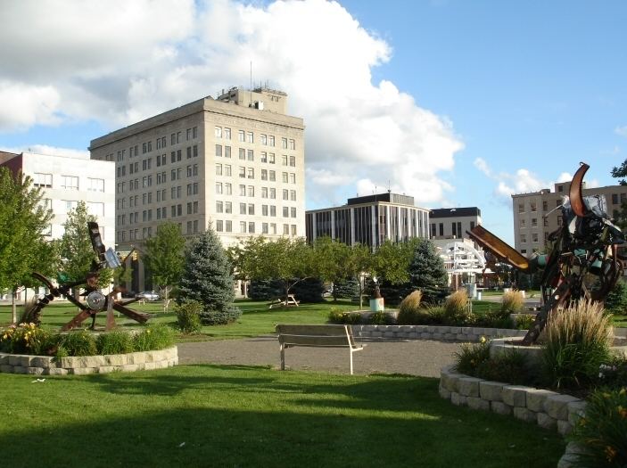
Map of Hammond, Indiana
Hammond is a city in Lake County, Indiana, United States. It is part of the Chicago metropolitan area. The population was 80,830 at the 2010 census, replacing Gary as the most populous city in Lake County.
Contents
- Map of Hammond Indiana
- Nine span bridge in hammond indiana in sr 152 indianapolis blvd
- Reginas southern cuisine
- Geography
- Lakes and rivers
- 2010 census
- 2000 census
- Cityscape
- Transportation
- Public transportation
- Medical centers and hospitals
- Utilities
- History
- National Register of Historic Places
- Major businesses
- School City of Hammond
- Colleges and universities
- Public libraries
- City government
- Sports
- The Hammond Pros 19201924
- Sister city
- Pastor david wilkerson eating drinking with the drunken
- References
Nine span bridge in hammond indiana in sr 152 indianapolis blvd
Reginas southern cuisine
Geography
Hammond is located at 41°36′40″N 87°29′35″W (41.611185, −87.493080).
The city's elevation above sea level ranges from 577 feet (176 m) to 610 feet (186 m). The city sits within the boundaries of the former Lake Chicago. Most of the city is on sandy soil with a layer of black topsoil that varies from non-existent to several feet (a meter or more) thick. Much of the exposed sand has been removed for purposes such as industrial use to make concrete and glass. According to the 2010 census, Hammond has a total area of 24.886 square miles (64.45 km2), of which 22.78 square miles (59.00 km2) (or 91.54%) is land and 2.106 square miles (5.45 km2) (or 8.46%) is water.
Lakes and rivers
2010 census
As of the census of 2010, there were 80,830 people, 29,949 households, and 19,222 families residing in the city. The population density was 3,548.3 inhabitants per square mile (1,370.0/km2). There were 32,945 housing units at an average density of 1,446.2 per square mile (558.4/km2). The racial makeup of the city was 59.4% White, 22.5% African American, 0.5% Native American, 1.0% Asian, 13.3% from other races, and 3.3% from two or more races. Hispanic or Latino of any race were 34.1% of the population.
There were 29,949 households of which 36.2% had children under the age of 18 living with them, 37.0% were married couples living together, 19.7% had a female householder with no husband present, 7.5% had a male householder with no wife present, and 35.8% were non-families. 30.3% of all households were made up of individuals and 9.7% had someone living alone who was 65 years of age or older. The average household size was 2.67 and the average family size was 3.36.
The median age in the city was 33.3 years. 27.6% of residents were under the age of 18; 10.1% were between the ages of 18 and 24; 27.3% were from 25 to 44; 24.2% were from 45 to 64; and 10.7% were 65 years of age or older. The gender makeup of the city was 49.0% male and 51.0% female.
2000 census
As of the census of 2000, there were 83,048 people, 32,026 households and 20,880 families residing in the city. The population density was 3,630.0 per square mile (1,401.4/km²). There were 34,139 housing units at an average density of 1,492.2 per square mile (576.1/km²). The racial makeup of the city was 72.35% White, 14.57% African American, 0.41% Native American, 0.46% Asian, 0.08% Pacific Islander, 9.32% from other races, and 2.81% from two or more races. Hispanic or Latino of any race were 21.04% of the population.
There were 32,026 households out of which 31.8% had children under the age of 18 living with them, 42.9% were married couples living together, 16.9% had a female householder with no husband present, and 34.8% were non-families. 29.7% of all households were made up of individuals and 10.9% had someone living alone who was 65 years of age or older. The average household size was 2.58 and the average family size was 3.23.
In the city, the population was spread out with 27.3% under the age of 18, 9.8% from 18 to 24, 30.1% from 25 to 44, 19.8% from 45 to 64, and 13.0% who were 65 years of age or older. The median age was 34 years. For every 100 females there were 95.3 males. For every 100 females age 18 and over, there were 92.2 males.
The median income for a household in the city was $35,528, and the median income for a family was $42,221. Males had a median income of $35,778 versus $25,180 for females. The per capita income for the city was $16,254. About 12.0% of families and 14.3% of the population were below the poverty line, including 19.7% of those under age 18 and 9.3% of those age 65 or over.
Cityscape
Transportation
Most of Hammond's streets are laid out in a grid pattern similar to Chicago's streets. While Madison Street in Chicago acts as the reference point for north-south street numbering the first "1" is removed; this makes what would be a five digit address number in Illinois into a four digit address number in Hammond. The state line is used as the reference point for east-west street numbering.
Other cities and towns in Northwest Indiana that use the Hammond numbering system are Whiting, Munster and Highland. Dyer also uses the Hammond numbering system but the first number removed from the north-south streets is a "2," as by that point the Illinois numbers across the state line start with the number 2 (Munster's street numbers start with a "1" north of the Dyer line, making them 5 digits); and East Chicago uses the canal located in the middle of the city as the east-west reference point, while embodying Hammond's numbering system for the north-south streets.
Public transportation
The South Shore Line, a Chicago to South Bend, Indiana commuter rail line, has a station on Hohman Avenue. It is operated by the Northern Indiana Commuter Transportation District.
Amtrak, the national passenger rail system, provides twice-daily service in both directions, operating its Wolverine through the Hammond–Whiting station between Chicago and Pontiac, Michigan, just north of Detroit. Baggage on Amtrak cannot be checked at this location; however, up to two suitcases in addition to any "personal items" such as briefcases, purses, laptop bags and infant equipment are allowed on board as carry-ons.
The nearest commercial airport is Chicago Midway International Airport about 25 miles away in Chicago.
Bus transit was provided by the Northwest Indiana Regional Bus Authority, which assumed responsibility from the city's Hammond Transit System in 2010, establishing EasyGo Lake Transit system in its place. All EasyGo buses were discontinued on June 30, 2012 due to a lack of funding. In addition, Pace routes 350 and 364 and GPTC Tri-City Connection Route 12 from Gary, Indiana stop at Hammond's Dan Rabin Transit Plaza.
Medical centers and hospitals
The only hospital in Hammond is Franciscan St. Margaret Health on Stateline Road, across the street from Calumet City, Illinois. It is an accredited chest pain center serving Northwest Indiana and the south suburbs of Chicago. The hospital was founded in late 1898 and was originally called St. Margaret Hospital, later merging with Our Lady Of Mercy Hospital in Dyer, Indiana, in the 1990s and was part of the former Sisters of St. Francis Health Services.
Utilities
History
The first permanent residents arrived around 1847 to settle on land between the Grand and Little Calumet rivers, on the south end of Lake Michigan. Those first residents were German farmers newly arrived from Europe looking for land and opportunity. Before that time, the area was a crossroad for Indian tribes, explorers, stagecoach lines and supply lines to the West. Convenient location and abundant fresh water from Lake Michigan led to the beginning of Hammond's industrialization in 1869 with the George H. Hammond Company meat-packing plant following merchants and farmers to the area. Hammond was incorporated on April 21, 1884, and was named after the Detroit butcher. Hammond is one of the oldest cities in Lake County, with Crown Point being the oldest, established in 1834. According to the Encyclopedia of Chicago, George Henry Hammond, a pioneer in the use of refrigerated railcars for the transport of fresh meat, first used this method with his small packing company in Detroit, Michigan. In 1868, Hammond received a patent for a refrigerator car design. In the early 1870s, he built a new plant in northern Indiana along the tracks of the Michigan Central Railroad. By 1873, the George H. Hammond Co. was selling $1 million worth of meat a year; by 1875, sales were nearly $2 million. The company's large packing house in Hammond—the town had taken the name of its most powerful resident—rivaled those located at the Union Stock Yard in Chicago. By the middle of the 1880s, when it built a new plant in Omaha, Nebraska, Hammond was slaughtering over 100,000 cattle a year and owned a fleet of 800 refrigerator cars. After Hammond died in 1886, the company became less important and no longer challenged the giant Chicago packers, who acquired Hammond at the turn of the century and merged it into their National Packing Co.
On June 22, 1918, the Hammond circus train wreck occurred about 5.5 miles (8.9 km) east of the city, killing 86 and injuring 127 persons.
According to the 1960 U.S. Census Hammond's population reached a record high of 111,698 residents.
National Register of Historic Places
The following single properties and national historic districts are listed on the National Register of Historic Places:
Major businesses
According to the city, those businesses employing 200 or more employees in Hammond are:
School City of Hammond
Hammond is served by the School City of Hammond, a school corporation under Indiana state law that is independent of the civil city.
Colleges and universities
Public libraries
Hammond Public Library, located at 564 State Street, includes the Suzanne G. Long Local History Room. The system used to operate the E.B. Hayward Branch at 1212 172nd Street and the Howard Branch at 7047 Grand Avenue. Both branches have since been closed.
City government
Hammond is incorporated as a city under Indiana law. It therefore has a mayor and a nine-member city council. Hammond's City Hall is located at 5925 Calumet Avenue. The Hammond City Council has meetings scheduled for the second and fourth Mondays of each month.
The city maintains a city court on the second floor of the City Hall, exercising a limited jurisdiction within Lake County. The court handles not only local ordinance violations and certain minor criminal matters, but also a significant portion of the debt collection and eviction actions brought in Lake County.
Sports
Hammond came in 2nd (against Taipei, Taiwan) in the 1972 Little League World Series.
The Hammond Pros (1920–1924)
The Hammond Pros was one of the earliest professional football teams in the United States. When the American Professional Football League was formed in 1920, the Hammond Pros was a charter member, as it also was when the league changed its name to National Football League in 1922. However, four years later, when the NFL decided to reduce the number of teams, it did so by simply folding smaller franchises; the Hammond Pros (which never played a home game in Hammond) was moved to Akron, Ohio, and became the Akron Pros in 1925.
During the four years of the Hammond Pros' existence, the NFL had nine African-American players, six of whom played for the Pros. The NFL's first African-American head coach was Hall-of-Famer coach Fritz Pollard of the Pros.