
Time zone GMT +5 (UTC+5) Population 44,080 (2009) | Area 10,502 km² Local time Tuesday 7:14 AM | |
 | ||
Weather -6°C, Wind S at 3 km/h, 94% Humidity University University of Central Asia, Naryn | ||
Naryn District' (formerly Tian'-Shan' District) is a raion of Naryn Region in central-southern Kyrgyzstan. The capital lies at Naryn. Naryn District was established in its borders in 1930. It borders with At-Bashy District to the south, Ak-Talaa District to the west, Kochkor District to the north, Tong District to the north-east, Jeti-Oguz District to the east, and Song Köl to the north-west. Its area is 10,502 square kilometres (4,055 sq mi), and its resident population was 44,080 in 2009.
Contents
Map of Naryn District, Kyrgyzstan
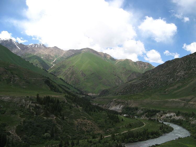
The district is characterized by the scenic Tian Shan Mountains, alpine pastures and Son-Kul lake which during summer months attracts large herds of sheep and horses with their herders and their yurts.
Economy
The economy of Naryn oblast is dominated by animal herding (sheep, horses, yaks), with wool and meat as the main products. Mining of various minerals developed during the Soviet era has largely been abandoned as uneconomical. Today the area is considered to be the poorest region in the country.
Ethnic composition
According to the 2009 Census, the ethnic composition (de jure population) of the Naryn District was:
Rural communities and villages
Naryn District includes 39 villages in 15 rural communities (aiyl okmotus). The rural communities and settlements in the Naryn District are:
- Ak-Kuduk aiyl okmotu (center - village Segizinchi Mart, and also villages Ak-Kuduk, Shoro)
- Debelyuu aiyl okmotu (center - village Debelyuu, and also villages Alysh, Kenesh)
- Jan-Bulak (center - village Jan-Bulak)
- Jergetal aiyl okmotu (center - village Jergetal, and also villages Jalgyz-Terek, Kyzyl-Jyldyz)
- Kara-Kudjur aiyl okmotu (center - village Lakol, and also village Jer-Kökchü)
- Kazan-Kuygan aiyl okmotu (center - village Kazan-Kuygan, and also village Kara-Unkyur)
- Emgekchil aiyl okmotu (center - village Emgekchil)
- Min-Bulak aiyl okmotu (center - village Kuybysheva, and also villages Min-Bulak, Ornok)
- On-Archa aiyl okmotu (center - village Echki-Bashy, and also village Ottuk)
- Ortok aiyl okmotu (center - village Tash-Bashat, and also villages Kaiyndy, Oryuk-Tam, Eki-Naryn)
- Uchkun aiyl okmotu (center - village Kulanak, and also village Uchkun)
- Chet-Nura aiyl okmotu (center - village Orto-Nura, and also villages Ak-Bulun, Ak-Kyya, Iyri-Suu, Orto-Saz, Oryuk-Tam, Chet-Nura, Tosh-Bulak)
- Emgek-Talaa aiyl okmotu (center - village Ak-Talaa, and also villages Tegerek, Emgek-Talaa)
- Sary-Oy aiyl okmotu (center - village Jylan-Aryk)
- Dostuk rural community (Dostuk)