
Car plates ONA Area 747.7 km² | Population 43,957 (2006) | |
 | ||
Gminas Total 5Gmina DomaszowiceGmina NamysłówGmina PokójGmina ŚwierczówGmina Wilków | ||
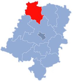
Namysłów County (Polish: powiat namysłowski) is a unit of territorial administration and local government (powiat) in Opole Voivodeship, south-western Poland. It came into being on January 1, 1999, as a result of the Polish local government reforms passed in 1998. Its administrative seat and only town is Namysłów, which lies 48 kilometres (30 mi) north of the regional capital Opole.
Contents
Map of Namys%C5%82%C3%B3w County, Poland
The county covers an area of 747.67 square kilometres (288.7 sq mi). As of 2006 its total population is 43,957, out of which the population of Namysłów is 16,557 and the rural population is 27,400.
Neighbouring counties
Namysłów County is bordered by Kępno County to the north-east, Kluczbork County to the east, Opole County to the south, Brzeg County to the south-west, and Oława County and Oleśnica County to the west.
Administrative division
The county is subdivided into five gminas (one urban-rural and four rural). These are listed in the following table, in descending order of population.