
Time zone CET (UTC+1) Area 19.39 km² Population 228 (1999) | INSEE/Postal code 80580 /80120 Local time Monday 12:34 PM | |
 | ||
Weather 11°C, Wind SW at 26 km/h, 82% Humidity | ||
Nampont (or Nampont-Saint-Martin) is a commune in the Somme department in Hauts-de-France in northern France.
Contents
Map of 80120 Nampont, France
Geography
Nampont is situated on the banks of the Authie river, at the junction of the N1 and D12 roads and on the border of the departments of the Somme and the Pas-de-Calais.
Places and monuments
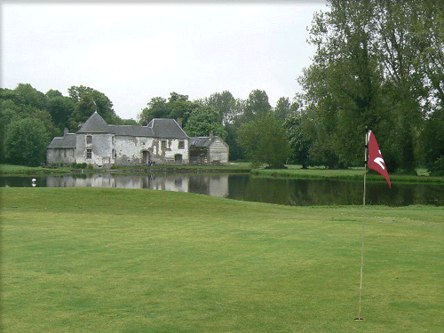
The ‘Maison Forte’, built in the 15th century as a border-post on the Authie. After the Spanish invasion, it was transformed into a customs post for the imposition of the ‘Gabelle’ (taxes levied on salt and other commodities, between Spanish Artois and French Picardy Nowadays, the Maison Forte is the clubhouse of Nampont-Saint-Martin golf club. Public access is limited to exterior views from the road or the courtyard.
References
Nampont Wikipedia(Text) CC BY-SA