
Chinese 泥涌 IPA [nɐ̏i tsʰʊ́ŋ] | Hanyu Pinyin Jyutping nai4 cung1 | |
 | ||
hong kong hiking wong nai chung gap trail
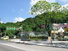
Nai Chung is a countryside in northeastern New Territories, Hong Kong. It is located at the east of Ma On Shan, partly lying within the Ma On Shan Country Park. Despite its proximity to the neighbouring areas administered by Sha Tin and Sai Kung districts, it is actually administered by Tai Po District. It is covered by the Sai Kung North constituency at the Tai Po District Council. Nai Chung lies in a larger area collectively known as Shap Sze Heung.
Contents
- hong kong hiking wong nai chung gap trail
- Map of Nai Chung Hong Kong
- hong kong hiking tour quarry bay mtr mount parker tai tam wong nai chung wan chai
- Transport
- References
Map of Nai Chung, Hong Kong
It contains barbecue sites, which are popular destinations of school picnics, and some restaurants that serve Thai and Indian food.
hong kong hiking tour quarry bay mtr mount parker tai tam wong nai chung wan chai
Transport
Sai Sha Road, which connects Ma On Shan to Sai Kung, is the only road that goes via Nai Chung. The Kowloon Motor Bus Company (KMB) has bus routes that serve Nai Chung:
There are also two green minibus routes go there.