
Phone number 0238-84-2111 Population 27,809 (Oct 2015) | Area 214.7 km² Local time Monday 8:40 AM | |
 | ||
Weather 4°C, Wind W at 14 km/h, 57% Humidity Points of interest Kumano Shrine, Somiya Shrine, けん玉広場spike, Mt Iwaigame | ||
Nagai (長井市, Nagai-shi) is a city located in Yamagata Prefecture, in the Tohoku region of northern Japan.
Contents
- Map of Nagai Yamagata Prefecture Japan
- Geography
- Neighboring municipalities
- Climate
- History
- Economy
- Education
- Rail
- Highways
- Twin towns Sister cities
- Notable people
- References
Map of Nagai, Yamagata Prefecture, Japan
As of October 2015, the city had an estimated population of 27,809 and a population density of 130 persons per km². The total area was 214.67 square kilometres (83 sq mi).
Geography
Nagai is located in mountainous southern Yamagata Prefecture. The Mogami River passes through the city, which includes Mount Asahi within its borders.
Neighboring municipalities
Climate
Nagai has a humid continental climate (Köppen climate classification Dfa) with very warm summers and cool winters. Precipitation is plentiful throughout the year, although the months from February to June have somewhat less rainfall.
History
The area of present-day Nagai was part of Dewa Province. The modern city of Nagai was founded on November 15, 1954.
Economy
The economy of Nagai is based on agriculture and light manufacturing.
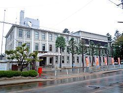
Education
Nagai has six elementary schools, two middle schools and two high schools.