
 | ||
NEXRAD or Nexrad (Next-Generation Radar) is a network of 159 high-resolution S-band Doppler weather radars operated by the National Weather Service (NWS), an agency of the National Oceanic and Atmospheric Administration (NOAA) within the United States Department of Commerce, the Federal Aviation Administration (FAA) within the Department of Transportation, and the U.S. Air Force within the Department of Defense. Its technical name is WSR-88D, which stands for Weather Surveillance Radar, 1988, Doppler.
Contents
- Deployment
- Scan strategies
- Upcoming 2017 VCP changes
- Super resolution
- Dual polarization
- AVSET
- SAILS and MESO SAILS
- MRLE
- Coverage gaps
- Phased array
- Usage
- References
NEXRAD detects precipitation and atmospheric movement or wind. It returns data which when processed can be displayed in a mosaic map which shows patterns of precipitation and its movement. The radar system operates in two basic modes, selectable by the operator – a slow-scanning clear-air mode for analyzing air movements when there is little or no activity in the area, and a precipitation mode, with a faster scan for tracking active weather. NEXRAD has an increased emphasis on automation, including the use of algorithms and automated volume scans.
Deployment
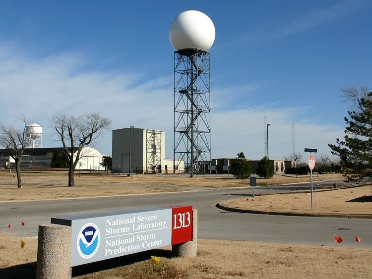
In the 1970s, the U.S. Department of Commerce, Department of Defense and Department of Transportation found the need to replace the existing national radar network, consisting of WSR-74 and WSR-57 radars not utilizing Doppler technology that were respectively developed in 1974 and 1957, to better serve their operational needs. The Joint Doppler Operational Project (JDOP) was formed in 1976 at the National Severe Storms Laboratory (NSSL) to study the usefulness of using Doppler radar to identify severe and tornadic thunderstorms. Tests over the next three years, conducted by the National Weather Service and the Air Weather Service agency of the U.S. Air Force, found that Doppler radar provided much improved early detection of severe thunderstorms. A working group that included the JDOP published a paper providing the concepts for the development and operation of a national weather radar network. In 1979, the NEXRAD Joint System Program Office (JSPO) was formed to move forward with the development and deployment of the proposed NEXRAD radar network. That year, the NSSL completed a formal report on developing the NEXRAD system.
When the proposal was presented to the Reagan administration, options were considered to build the radar systems: either allowing corporate bids to build the systems based on the schematics of the previously developed prototype radar or seek contractors to build their own systems using predetermined specifications. The JSPO group opted to select a contractor to develop and produce the radars that would be used for the national network. Radar systems developed by Raytheon and Unisys were tested during the 1980s, however it took four years to allow the prospective contractors to develop their proprietary models. Unisys was selected as the contractor, and was awarded a full-scale production contract in January 1990.
Installation of an operational prototype was completed in the fall of 1990 in Norman, Oklahoma. The first installation of a WSR-88D for operational use in everyday forecasting was in Sterling, Virginia on June 12, 1992. The last system deployed as part of this installation campaign was installed in North Webster, Indiana on August 30, 1997. In 2011, a single new radar was added at Langley Hill, Washington to better cover the Pacific Coast of that area; other radars also filled gaps in coverage at Evansville, Indiana and Ft. Smith, Arkansas following the initial installations. The site locations were strategically chosen to provide the most overlapping coverage between radars in case one failed during a severe weather event. Where possible, they were co-located with NWS Weather Forecast Offices (WFOs) to permit quicker access to maintenance technicians.
The NEXRAD radars incorporated a number of improvements over the radar systems that were previously in use. The new system provided Doppler velocity, improving tornado prediction ability by detecting any rotation present within the storm at different scan angles. It provided improved resolution and sensitivity, allowing operators to see features such as cold fronts, thunderstorm gust fronts, and mesoscale to even storm scale features of thunderstorms that had never been visible on radar. The NEXRAD radars also provided volumetric scans of the atmosphere allowing operators to interrogate the vertical structure of storms and additionally can act as wind profilers in providing detailed wind information for several kilometres above the radar site. The radars also had a much increased range allowing detection of weather features at much greater distances from the radar site.
WSR-88D development, maintenance, and training are coordinated by the NEXRAD Radar Operations Center (ROC) located at the National Weather Center (NWC) in Norman, Oklahoma.
Scan strategies
Unlike its predecessor, the WSR-88D antenna is not directly controllable by the user. Instead, the radar system continually refreshes its three-dimensional database via one of several predetermined scan patterns. Since the system samples the atmosphere in three dimensions, there are many variables that can be changed, depending on the desired output. Traditionally, the Antenna scans at a maximum of 19.5 degrees in elevation, and a minimum of .5, however experimental builds of the NEXRAD system have had the Antenna scan at a minimum and maximum of -1 degrees and 45 degrees, respectively. Due to the traditionally vertically incomplete coverage, a phenomenon known as "The Cone of Silence" is present with all NEXRAD radars. The phenomenon describes the lack of vertical radar coverage, usually directly over the site of the radar. There are currently nine Volume Coverage Patterns (VCP) available to NWS meteorologists. Each VCP is a predefined set of instructions that control antenna rotation speed, elevation angle, transmitter pulse repetition frequency and pulse width. The radar operator chooses from the VCPs based on the type of weather occurring:
Upcoming 2017 VCP changes
In October 2015, the National Weather Service announced that an upcoming software update would eliminate multiple precipitation mode VCPs, and replace them with a single VCP intended to combine the best features of the VCPs being eliminated. An additional clear air mode will also be made available.[1]
As of the upcoming Build 18 update, scheduled for deployment in Mid-october of 2017, the following VCPs will be available:
Super resolution
Deployed from March to August 2008, the Super Resolution upgrade permitted the capability of the radar to produce much higher resolution data. Under legacy resolution, the WSR-88D provides reflectivity data at 1 km (0.62 mi) by 1 degree to 460 kilometres (290 mi) range, and velocity data at 0.25 km (0.16 mi) by 1 degree to a range of 230 km (140 mi). Super Resolution provides reflectivity data with a sample size of 0.25 km (0.16 mi) by 0.5 degree, and increase the range of Doppler velocity data to 300 km (190 mi). Initially, the increased resolution is only available in the lower scan elevations. Super resolution makes a compromise of slightly decreased noise reduction for a large gain in resolution.
The improvement in azimuthal resolution increases the range at which tornadic mesoscale rotations can be detected. This allows for faster lead time on warnings and extends the useful range of the radar. The increased resolution (in both azimuth and range) increases the detail of such rotations, giving a more accurate representation of the storm. Along with providing better detail of detected precipitation and other mesoscale features, Super Resolution also provides additional detail to aid in other severe storm analysis. Super Resolution extends the range of velocity data and provides it faster than before, also allowing for faster lead time on potential tornado detection and subsequent warnings.
Dual polarization
WSR-88D sites across the nation have been upgraded to polarimetric radar, which adds vertical polarization to the horizontal radar waves, in order to more accurately discern what is reflecting the signal. This so-called dual polarization allows the radar to distinguish between rain, hail and snow, something the horizontally polarized radars cannot accurately do. Early trials showed that rain, ice pellets, snow, hail, birds, insects, and ground clutter all have different signatures with dual polarization, which could mark a significant improvement in forecasting winter storms and severe thunderstorms. The deployment of the dual polarization capability (Build 12) to NEXRAD sites began in 2010 and was completed by the summer of 2013. The radar at Vance Air Force Base in Enid, Oklahoma is the first operational WSR-88D to be modified to utilize dual polarization technology; the modified radar went into operation on March 3, 2011.
AVSET
When the NEXRAD system was initially implemented, the radar automatically scanned all scan angles in a Volume Coverage Pattern, even if the highest scan angles were free of precipitation. As a result, in many cases when severe weather was further from the radar site, forecasters could not provide as timely severe weather warnings as possible. The Automated Volume Scan Evaluation and Termination (AVSET) algorithm helps solve this problem by immediately ending the volume scan when precipitation returns at higher scan angles drop below a set threshold (around 20 dBZ). This can often allow for more volume scans per hour, improving severe weather detection without the need for hardware upgrades AVSET was initially deployed in RPG build 12.3, in Fall of 2011.
SAILS and MESO-SAILS
One of the primary weaknesses of the WSR-88D radar system was the lack of frequency of base (0.5 degree) scans, especially during severe weather. Forecasters, and TV viewers at home, often had access to images that were four or five minutes old, and therefore had inaccurate information. TV viewers at home could be lulled into a false sense of security that a tornado was farther away from them than it really was, endangering residents in the storm's path. The Supplemental Adaptive Intra-Volume Low-Level Scan (SAILS) technique, deployed with Build 14 in the first half of 2014, allows operators the option to run an additional base scan during the middle of a typical volume scan. With one SAILS cut active on VCP 212, base scans occur about once every two minutes and fifteen seconds, with more frequent updates if AVSET terminates the volume scan early.
Multiple Elevation Scan Option for Supplemental Adaptive Intra-Volume Low-Level Scan (MESO-SAILS) is an enhancement to SAILS, which allows the radar operator to run one, two or three additional base scans during the course of a volume scan, per the operators request. During June 2013, the Radar Operations Center first tested SAILSx2, which adds two additional low-level scans per volume. It was executed for approximately 4 and 1/2 hours and during the testing, a Radar Technician observed the pedestal/antenna assembly's behavior. No excessive wear was noted to the assembly of the Radar. Two days later, SAILSx3 was executed, which added 3 additional low-level scans to a volume. During this 1 1/2 hour test of SAILSx3, a ROC Radar Hardware Engineer accompanied the ROC Electronics Maintenance Technician to observe the antenna/pedestal assembly. Again, no excessive wear was noted. MESO-SAILS was deployed with Build 16.1, in spring of 2016.
MRLE
During Quasi-Linear Convective Systems (QLCS), colloquially known as squall lines, the detection of mesovortices, which generate at 4,000 to 8,000 feet above ground level, is not always possible with SAILS cuts, as the base 0.5 degree scan travels below the formation of mesovortices at closer distances to the radar. Mid-Volume Rescan of Low-Level Elevations (MRLE) consecutively scans either the two, three or four lowest scan angles during the middle of a typical volume scan, allowing more frequent surveillance of mesovortex formation during QLCS events. MRLE will be deployed on a non-operational basis in RPG 18.0 in Fall of 2017, with possible operational deployment at a later date.
The National Weather Service keeps a list of upcoming improvements to the WSR-88D system.
Coverage gaps
WSR-88D has coverage gaps below 10,000 feet (or no coverage at all) in many parts of the continental United States, often for terrain or budgetary reasons, or remoteness of the area. Such notable gaps include most of Alaska; several areas of Oregon, including the central and southern coast and much of the area east of the Cascade Mountains; many portions of the Rocky Mountains; Pierre, South Dakota; portions of northern Texas; large portions of the Nebraska panhandle; and areas near the borders of the Oklahoma and Texas Panhandles. Notably, many of these gaps lie in tornado alley. At least one tornado has gone undetected by WSR-88D as a result of such a coverage gap – an EF1 tornado in Lovelady, Texas in April 2014. As a result of the coverage gap, initial reports of tornadic activity were treated with skepticism by the local National Weather Service forecast office.
Coverage gaps can also be caused during radar outages, especially in areas with little to no overlapping coverage. A radar failure on July 16, 2013 resulted in an outage that lasted through early August
A coverage gap in North Carolina encouraged Senator Richard Burr to propose S. 2058, also known as the Metropolitan Weather Hazard Protection Act of 2015. The act mandates that any city with a population of 700,000 or more must have Doppler Radar coverage <6,000 feet above ground level. The bill passed the Senate, but died in a House committee.
It is not likely that additional WSR-88Ds will be deployed, as the production line was shut down in 1997, and the National Weather Service has an insufficient budget to restart production. In 2011, a known coverage gap was filled when the Langley Hill radar in southwestern Washington was installed, using the last remaining spare. This radar opportunity was spearheaded by a public campaign led by Prof. Clifford Mass at the University of Washington, and likely helped the NWS office in Portland to issue a timely warning for the Manzanita, OR EF-2 tornado in October, 2016.
Phased array
Beyond dual-polarization, the advent of phased array radar will probably be the next major improvement in severe weather detection. Its ability to rapidly scan large areas would give an enormous advantage to radar meteorologists. Any large-scale installation by the NWS is unlikely to occur before 2020. The National Severe Storms Laboratory predicts that a phased array system will eventually replace the current network of WSR-88D radar transmitters.
Usage
NEXRAD data is used in multiple ways. It is used by National Weather Service meteorologists and (under provisions of U.S. law) is freely available to users outside of the NWS, including researchers, media, and private citizens. The primary goal of NEXRAD data is to aid NWS meteorologists in operational forecasting. The data allows them to accurately track precipitation and anticipate its development and track. More importantly, it allows the meteorologists to track and anticipate severe weather and tornadoes. Combined with ground reports, tornado and severe thunderstorm warnings can be issued to alert the public about dangerous storms. NEXRAD data also provides information about rainfall rate and aids in hydrological forecasting. Data is provided to the public in several different forms, the most basic form being graphics published to the NWS website. Data is also available in two similar, but different, raw formats. Available directly from the NWS is Level III data, consisting of reduced resolution, low-bandwidth base products as well as many derived, post-processed products; Level II data consists of only the base products, but at their original resolution. Because of the higher bandwidth costs, Level II data is not available directly from the NWS. The NWS distributes this data freely to several top-tier universities which in turn distribute the data to private organizations.