NATO Integrated Air Defense System (short: NATINADS) is according to the German army regulation German: Heeresdienstvorschrift (HDv) 100/900 defined as – «A command and control compound (structure or system) of the alliance´s air defence forces, subordinated to the NATO command authorities, already in peace time as well as in crisis and war».
Development was approved by the NATO Military Committee in December 1955. The system was to be based on four air defense regions (ADRs) coordinated by SACEUR (Supreme Allied Commander Europe). Starting from 1956 early warning coverage was extended across Western Europe using 18 radar stations. This part of the system was completed by 1962. Linked to existing national radar sites the coordinated system was called the NATO Air Defence Ground Environment (NADGE).
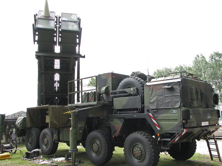
From 1960 NATO countries agreed to place all their air defence forces under the command of SACEUR in the event of war. These forces included command & control (C2) systems, radar installations, and Surface-to-Air (SAM) missile units as well as interceptor aircraft.
By 1972 NADGE was converted into NATINADS consisting of 84 radar sites and associated Control Reporting Centers (CRC) and in the 1980s the Airborne Early Warning / Ground Environment Integration Segment (AEGIS) upgraded the NATINADS with the possibility to integrate the AWACS radarpicture and all of its information into its visual displays. (NOTE: This AEGIS is not to be confused with the U.S.Navy AEGIS, a shipboard fire control radar and weapons system.) AEGIS processed the information through Hughes H5118ME computers, which replaced the H3118M computers installed at NADGE sites in the late 1960s and early 1970s.
NATINADS ability to handle data increased with faster clock rates. The H5118M computer had a staggering 1 megabyte of memory and could handle 1.2 million instructions per second while the former model had a memory of only 256 kilobytes and a clock speed of 150000 instructions per seconds.
NATINADS/AEGIS were complemented, in W-Germany by the German Air Defence Ground Environment (GEADGE), an updated radar network adding the southern part of W-Germany to the European system and Coastal Radar Integration System (CRIS), adding data links from Danish coastal radars.
In order to counter the hardware obsolescence, during the mid-90's NATO started the AEGIS Site Emulator (ASE) program allowing the NATINADS/AEGIS sites to replace the proprietary hardware (the 5118ME computer and the various operator consoles IDM-2, HMD-22, IDM-80) with Commercial-Off-the-Shelf servers and workstations.
In the first years 2000, the initial ASE capability was expanded with the possibility to run, thanks to the new hardware power, multiple site emulators on the same hardware, so the system was renamed into Multi-AEGIS Site Emulator (MASE). The NATO system designed to replace MASE in the near future is the Air Command and Control System (ACCS).
Because of changing politics, NATO expanding and financial crises most European (NATO) countries are trying to cut defence budgets; as a direct result lots of obsolete and outdated NATINADS facilities are phased out earlier. Currently (2013) still operational NATO radar sites in Europe are these:
Regional Air Operations Centre 2 (German: Einsatzführungsbereich 2 - EFB 2) with CRC ErndtebrückSensor platoon II - North (Sensorzug II - Nord), AuenhausenRemote Radar Post 241 (AbgTZg 241), Crabtree (CT), Marienbaum, HADRRemote Radar Post 242 (AbgTZg 242), Backwash (BW), Brakel (Auenhausen), GM406FRemote Radar Post 243 (AbgTZg 243), Silver Cork (SI), Visselhövede, GM406FRemote Radar Post 244 (AbgTZg 244), Round up (RU), Aurich / Brockzetel, HADRRemote Radar Post 245 (AbgTZg 245), Bugle (BG), Brekendorf, GM406FSensor platoon I - South (Sensorzug I - Süd), LaudaRemote Radar Post 246 (AbgTZg 246), Hardwheel (HW), Birkenfeld (Erbeskopf), HADRRemote Radar Post 247 (AbgTZg 247), Batman (BN), Lauda-Königshofen, GM406FRemote Radar Post 248 (AbgTZg 248), Coldtrack (CD), Freising, GM406FRemote Radar Post 249 (AbgTZg 249), Sweet Apple (SA), Meßstetten, HADRRemote Radar Post 240 (AbgTZg 240), Lone Ship (LS), Erndtebrück, GM406FRegional Air Operations Centre 3 (EFB 3) with CRC SchönewaldeSensor platoon III (Sensorzug III), CölpinRemote Radar Post 351 (AbgTZg 351), Matchpoint (MP), Putgarten, RRP-117Remote Radar Post 352 (AbgTZg 352), Mindreadar (MR), Cölpin, RRP-117Remote Radar Post 353 (AbgTZg 353), Teddy Bear (TB), Tempelhof, RRP-117Remote Radar Post 356 (AbgTZg 356), Elemenhorst, RRP-117Sensor platoon IV (Sensorzug IV), RegenRemote Radar Post 354 (AbgTZg 354), Blackmoor (BM), Döbern, RRP-117Remote Radar Post 355 (AbgTZg 355), Poyal Flash (RF), Gleina, RRP-117Remote Radar Post 357 (AbgTZg 357), Schwarzenbach a.W., RRP-117Remote Radar Post 358 (AbgTZg 358), Snow Cap (SN), Bayrisch Eisenstein (Großer Arber), RRP-11740°34'55"N 23°6'59"E Chortiatis 1st Area Control Center38°10'27"N 23°42'55"E Parnitha 2nd Area Control Center35°3'50"N 26°9'11"E Ziros 3rd (Reserve) Area Control Center39°38'59"N 22°28'0"E Larissa airbase NATO Air Operations Center38°10'11"N 20°37'8"E Agios Eleftherios AD radar annex GKFZ troposcatter site in the ACE-High Cemetery net chain of communications.35°22'45"N 24°59'3"E Fodele remote radarstation35°34'13"N 27°9'47"E Karpathos Isl remote radarstation36°51'25"N 27°18'54"E Kos remote radarstation39°58'57"N 25°4'49"E Limnos W remote radarstation39°59'12"N 25°23'59"E Limnos E remote radarstation40°53'44"N 25°32'43"E Maroneia remote radarstation38°56'9"N 24°33'23"E Skiros radarstation35°18'24"N 23°36'34"E Sklavopoula radarstationCombined Air Operations Centre (CAOC 5) Poggio Renatico (44°47'32"N 11°29'41"E); also Aeronautica Militare Italia Gruppo Riporto e Controllo Difesa Aerea (GRCDA) - airdefense control & reporting center was a former NADGE and later NATINADS radarsite.
Poggio Ballone (42°49'37"N 10°52'59"E) 21º Gruppo Radar CRCLicola (40°51'52"N 14°3'9"E) 22º Gruppo Radar CRCMortara (45°13'54"N 8°48'15"E) 112 Squadriglia Radar RemotaLame di Concordia (45°44'36"N 12°52'31"E) 113ª Squadriglia Radar RemotaCapo Mele (43°57'28"N 8°10'9"E) 115ª Squadriglia Radar RemotaJacotenente (41°47'21"N 16°2'57"E) 131ª Squadriglia Radar RemotaCrotone (38°59'17"N 17°4'45"E) 132ª Squadriglia Radar RemotaMågerø (70°59'3"N 25°53'49"E) Control and Reporting CenterMt Gråkallen (63°25'12"N 10°15'3"E) remote controlled AD radarMt Njunis (68°43'54"N 19°32'4"E) remote controlled AD radarKirkenes airport(69°42'57"N 29°52'10"E) remote controlled AD radarKlettkovfjellet (67°10'23"N 15°1'41"E) remote controlled AD radarSelbu (63°18'41"N 10°56'18"E) remote controlled AD radarSørreisa (69°8'11"N 18°8'14"E) Control and Reporting CenterVågsøy (61°59'53"N 5°3'1"E) remote controlled AD radarVardø (70°22'0"N 31°7'35"E) remote controlled AD radarMonsanto Control and Reporting CenterBeja Alternative Control and Reporting CenterRadar Station 1 (ER 1), Fóia (37°18'52"N -9°6'14"E) located on the summit of Fóia MountainRadar Station 2 (ER 2), Pilar (41°17'26"N -9°34'27"E) located at Mount PilarRadar Station 3 (ER 3), Montejunto (39°10'23"N -10°56'58"E) at Montejunto RangeRadar Station 4 (ER 4), Arieiro (32°44′08″N -16°55′44″W) located at Arieiro Peak, MadeiraEVA 1, El Frasno (41° 24' 24" N -2° 30' 14" E) (EVA=Escuadrón de Vigilancia Aérea; early warning sqn)EVA 2, Villatobas (39° 53' 17" N -4° 41' 53" E) EVA 2EVA 3, Constantina (37° 55' 8" N -6° 24' 25" E) EVA 3EVA 4, El Peni (42° 16' 42" N 3° 14' 14" E)EVA 5, Alto de Aitana (38° 38' 56" N -1° 44' 4" E)EVA 7, Puig Mayor (39° 47' 59" N 2° 47' 58" E)EVA 10, Monte Iroite (42° 43' 24" N -9° 4' 42" E)EVA 12, Picón del Fraile (43° 10' 49" N -4° 1' 0" E)EVA 13, Sierra Espuña (37° 51' 44" N -2° 25' 30" E)EVA 14, Villanubla (41° 42' 0" N -5° 9' 0" E)EVA 21, Pico de las Nieves (Gran Canaria), 27°57′47″N 15°34′17.9″WEVA 22, Haria (Lanzarote), 29°07′12.6″N 13°31′15.1″WTorrejón (40° 28' 0" N -4° 13' 59" E) Escuadrilla de Circulación Aérea Operativa (ECAO) 1 (Airops Center)Gava (41° 17' 36" N 2° 1' 5" E) Escuadrilla de Circulación Aérea Operativa (ECAO) 4 (Airops Center)Artzamendi (43° 16' 58" N -2° 35' 33" E) Former CRC converted into a remote controlled AD radarInoges (41° 22' 17" N -2° 30' 11" E) Former CRC and USAF troposcatter communications site converted to a remote controlled AD radarRAF Benbecula (57°28'24.40"N 7°22'26.27"W) a remote radarstation providing long-range radar coverage of the North Atlantic approaches to Scotland. The data is fed into the Integrated Command and Control System within the UK.RAF Boulmer (55°25'13.89"N 1°36'6.69"W) HQ of the UK Air Surveillance and Control System (ASACS) Force. Using ground based military and civilian radars, the Control and Reporting Centre (C RAF Boulmer is responsible for compiling the Recognised Air Picture (RAP) within the UK airspace and its approaches. The CRC monitors the RAP 24/7 365 days a year detecting and identifying all aircraft within it and providing tactical control of assigned Quick Reaction Alert intercepting aircraft.RAF Buchan (57°27'27.90"N 1°48'45.81"W) Control Reporting Centre (CRC) Buchan is a remote radar station, but also capable of coordinating all air defence aspects in its Area of Responsibility within the UK Air Policing Area. The base can routinely work closely with similar NATO units abroad, NATO navies and Airborne Warning and Control aircraft.RAF Fylingdales (54°21'37.77"N 0°40'5.55"W) Ballistic missile warning and space surveillance station. Providing warning of ballistic missile events. Supporting the U.S. developing Missile Defense System. Contributing to the Allied Space Surveillance Network and enabling support UK forces worldwide through SatCom Warning Service.RAF High Wycombe (51°40'52.44"N 0°48'21.06"W) HQ Air Command and underground Operations Center.RAF Kirton in Lindsey (53°28'3.80"N 0°34'53.47"W) No.1 Air Control Centre (1ACC) relocated from RAF Boulmer.RAF Menwith Hill (54° 0'32.29"N 1°41'24.69"W) is an integral part of the British and US worldwide defence communications and intelligence gathering (Echelon) networks. Its primary mission is to provide intelligence support for UK, US and allied interests.RAF Neatishead (52°42'51.56"N 1°28'13.75"E) is a remote radarstation provide radar, ground-to-air radio and data links coverage as part of the UK Air Surveillance And Control System (ASACS), in support of national and NATO air defences.RAF Portreath (50°16'13.92"N 5°16'25.74"W) is a remote radarstation providing long-range radar coverage of the Atlantic approaches. The data is fed into the Integrated Command and Control System within the UK.RAF Saxa Vord (60°47'51.98"N 0°49'17.86"W) is a remote radarstation providing long-range radar coverage of its approaches. The data is fed into the Integrated Command and Control System within the UK.RAF Staxton Wold (54°11'13.98"N 0°26'6.89"W) is a remote radarstation providing long-range radar coverage of its approaches. The data is fed into the Integrated Command and Control System within the UK. Staxton Wold is one of the 16 radar sites forming the World War II Chain Home System, becoming y operational in 1939. It is the only one of the original World War II sites still operating, thus laying claim to be the worlds oldest radar site!Austrian radar (GOLDHAUBE)
Buschberg / Steinmandl (48° 34' 37"N 16° 23' 44"E) AustroControl operates a general air traffic control radar at the Buschberg summit; actually this is a combined civil / mil facility. An airforce remote search radar is located very near at the Steinmandl summit at lat/long position 48°34'42"N 16°24'37"EKolomannsberg (47° 52' 38"N 13° 16' 32"E) AD radarstationSwiss Air Force radar (FLORAKO)
La Dole (46°25'32"N 6°6'0"E) Skyguide aircontrol radarsiteLägern (47°28'54"N 8°23'41"E) Skyguide aircontrol radarsiteMount Pilatus (46° 58' 43"N 8° 15'6"E) C3 facility & AD radarstation inside Mt PilatusScopi(46° 34' 14"N 8° 49'46"E) C3 facility & AD radarstation inside Mt ScopiWeisshorn (46° 6' 6"N 7° 42'46"E) C3 facility & AD radarstation inside Mt WeisshornWeissfluh (46°50'6"N 9°47'39"E) C3 facility & AD radarstation inside Mt Weissfluh