
OS grid ST 259978 Prominence 253 m | Elevation 472 m Listing Marilyn | |
 | ||
Topo map OS Landranger 171 / Explorer 152 People also search for Mynydd y Lan, Mynydd Machen, Twmbarlwm | ||
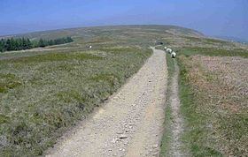
Mynydd Twyn-glas is a sprawling 472-metre-high mountain extending into Caerphilly and Torfaen county boroughs in South Wales. It lies southwest of Pontypool, west of Cwmbran and east of Newbridge and taking the form of a rolling plateau the margins of which are defined by steep slopes, many of which are cloaked with conifer plantations. A broad shoulder extending south from the summit is known as Mynydd Maen whilst to the north is Mynydd Llwyd. The thickly afforested northern slopes of the hill drop down steeply into Cwm y Glyn.
Contents
Map of Mynydd Twyn-glas, Pontypool, UK
GeologyEdit
The hill lies on the southeastern edge of the South Wales Coalfield. The summit plateau and upper slopes of the hill are formed from sandstones of the Pennant Sandstone Formation assigned to the Warwickshire Group of the late Carboniferous Period. Amongst coal seams outcropping along its eastern flanks are the Cefn Glas and Brithdir seams. The NE-SW aligned Glyn Fault cuts through the northwestern corner of the hill. A major landslip affects its southeastern slopes at Mynydd Henllys.
AccessEdit
The larger part of the open land of the hill is mapped as open access under the Countryside and Rights of Way Act 2000 and thereby open to access on foot by the public. In addition a number of public footpaths cross the hill and provide access from neighbouring towns and villages.