
Listing Ultra Easiest route glacier/snow climb First ascent 1956 First ascender E. A. Beletskiy | Elevation 7,546 m Prominence 2,735 m | |
 | ||
Similar Kongur Tagh, Ismoil Somoni Peak, Lenin Peak, Gasherbrum II, Cho Oyu | ||
Muztagh Ata, or Muztagata (Uyghur: مۇز تاغ ئاتا, Музтаң Ата, literally "ice-mountain-father"; Chinese: 慕士塔格峰; pinyin: Mùshìtǎgé Fēng), is the second highest (7509 metres) of the mountains which form the northern edge of the Tibetan Plateau (not the second highest of the mountains of the Tibetan Plateau). It is sometimes regarded as being part of the Kunlun Shan, although physically it is more closely connected to the Pamirs. It is also one of the relatively easier 7,000 m peaks in the world to climb, due to its gentle western slope and the comparatively drier weather of Xinjiang, though a thorough acclimatization period and a very strong physical condition are crucial for success.
Contents
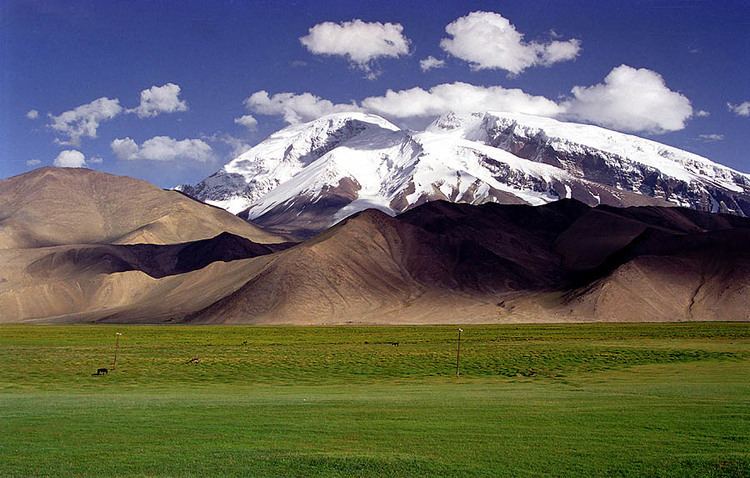
Map of Muztagata, Akto, Kizilsu, China
Location
Muztagh Ata (Turkish: Muz Dag (modern pronunciation Buz Dag [as in "men" versus "ben"- where Oguz Kaan lost his horse according to the legend) lies just south of Kongur Tagh, the highest peak of this somewhat isolated range that is separated from the main chain of the Kunlun by the large Yarkand River valley, and thus generally included in the "Eastern Pamirs". Not far to the north and east of this group are the lowlands of the Tarim Basin and the Taklamakan Desert. The Karakoram Highway passes very close to both peaks as well as Karakul Lake, from which the mountain is conveniently viewed. The closest city is to the mountain is Tashkurgan, the westernmost town in China and very close to the border with Pakistan.
History
According to Michael Witzel, "the Ṛgveda mentions the mountain Mūjavant (“Having Mūja”), from where the best soma comes. A Muža tribe is also found in the Avesta in an eastern area that has vedic-like names. The name seems to survive as the impressive 7,549-meter-high Muzh Tagh Ata Mountain in the Kirghiz and Sariqoli (Saka) lands of southwestern Xinjiang."
The Swedish explorer and geographer Sven Hedin made the first recorded attempt to climb Muztagh Ata, in 1894. Additional attempts were made in 1900, 1904 and 1947, the last by the team of Eric Shipton and Bill Tilman who came very close to the summit but were turned back due to cold and deep snow.
The first ascent of the peak was in 1956 by a large party of Chinese and Soviet climbers (including Liu Lianman) led by E.A. Beletskiy, via the west ridge, which is now the standard route.
Since the first ascent, many ascents of Muztagh Ata have been made. In 1980, a party led by Ned Gillette made a ski ascent/descent of the standard route, the first ski ascent of a mountain over 7,500 m (24,600 ft). An ascent of the much harder south-east ridge was made in 2000, and a secondary route at the west side of the mountain was first climbed in the summer of 2005. Sweden's Anneli Wester camped on the summit in 2011 after climbing the mountain solo and in alpine style.