
Length 114.3 km | ||
 | ||
History: Designated in 2016Expected completion in 2019 | ||
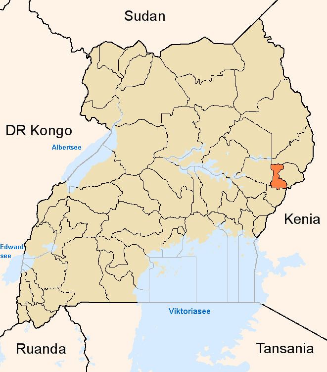
Muyembe–Nakapiripirit Road is a road in the Eastern and Northern regions of Uganda. The road connects the towns of Muyembe in Sironko District, to the town of Nakapiripirit in Nakapiripirit District.
Contents
Location
The road starts at Muyembe, approximately 35 kilometres (22 mi) northeast of Mbale, the largest city in Eastern Uganda. The road continues north to end at Nakapiripirit, a total distance of approximately 114 kilometres (71 mi). The coordinates of the road near Tabagonyi are 1°28'45.0"N, 34°24'56.0"E (Latitude:1.479179; Longitude:34.415548).
Upgrade to bitumen
Plans are underway to upgrade this gravel road to class II bitumen surface with road width of 7 metres (23 ft), shoulders of 1.5 metres (4.9 ft), with drainage channels and culverts. In December 2014, this road was listed as "At project preparation".
In March 2015, the Ugandan Parliament, authorized the borrowing of US$110 million, representing 86% of the cost, from the Islamic Development Bank (IDB). The government of Uganda will fund the remaining 14%, amounting to about US$18 million or local currency equivalent.
In December 2015, Uganda National Roads Authority advertised for construction companies to tender bids for the construction works, totalling 92 kilometres (57 mi) of main roads and an additional 25 kilometres (16 mi) of side roads and connectors, totalling 117 kilometres (73 mi). Following the evaluation of those bids, a preferred contractor will be selected and a construction contract will be executed between the parties concerned.