
Population 543 Sovereign state United Kingdom Local time Wednesday 3:46 AM Dialling code 01297 | OS grid reference SY275945 Postcode district EX13 | |
 | ||
Weather 6°C, Wind S at 29 km/h, 96% Humidity | ||
Musbury is a village and civil parish in the East Devon district of Devon, England. It lies approximately 2 miles away from Colyton and 2.5 miles away from Axminster, the nearest towns. Musbury is served by the A358 road and lies on the route of the East Devon Way, a 40-mile footpath following the Axe Valley. The village is within the East Devon Area of Natural Beauty. It has a post office, primary school, fuel station and church. The parish population at the 2011 census was 543.
Contents
Map of Musbury, Axminster, UK
History
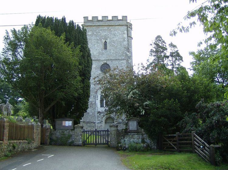
The village takes its name from the Iron Age hill fort of Musbury Castle on the hill above it, from which there are excellent views of the Axe Valley. The parish church, which is dedicated to St. Michael, is a 15th-century structure that was much rebuilt and restored by the Victorians. It contains the Drake Memorial dating from 1611. A portrait of the village in 1940 appears in the final chapter of Cecil Day-Lewis's memoir The Buried Day.