
Country United States Population 107,479 (2013) Unemployment rate 5.5% (Feb 2015) Area 33.613 sq mi | State California | |
Murrieta is a city in southwestern Riverside County, California, United States. The population of Murrieta was 103,466 at the 2010 census. Murrieta experienced a 133.7% population increase between 2000 and 2010, according to the most recent census, making Murrieta one of the fastest growing cities in the state. This population boom in 2010 surpassed the population of the historically larger and more commercial city of Temecula to the south for the first time since the incorporation of either city. Temecula and Murrieta together form the southwestern anchor of the Inland Empire region. The Murrieta-Temecula-Menifee Urban Area had a population of 441,546 at the 2010 Census. Largely residential in character, Murrieta is typically characterized as a commuter town, with many of its residents commuting to jobs in San Diego County, Orange County, Los Angeles County, Temecula, and Camp Pendleton.
Contents
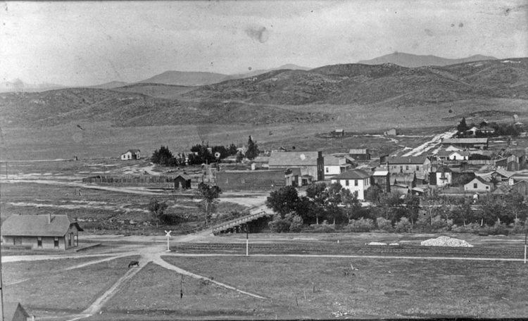
- Map of Murrieta California
- The best place to buy wine vino pariaso wine store murrieta
- History
- Geography
- Economy
- Entertainment
- References
Map of Murrieta, California
Murrieta is bordered by Temecula to the south and the newly incorporated cities of Menifee and Wildomar to the north.
The best place to buy wine vino pariaso wine store murrieta
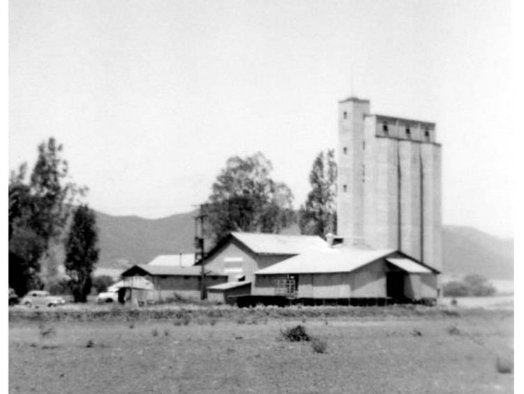
History
For most of its history Murrieta was not heavily populated. A Basque, Esequial Murrieta, purchased the Rancho Pauba and Rancho Temecula Mexican land grants, comprising 52,000 acres (210 km2) in the area, intending to bring his sheep-raising business to California. He returned to Spain, however, and turned the land over to his younger brother, Juan (1844–1936), who brought 100,000 sheep to the valley in 1873, using the meadows to feed his sheep. Others discovered the valley after the construction of a depot in 1882 that connected Murrieta to the Southern California Railroads transcontinental route. By 1890 some 800 people lived in Murrieta. Today much of the site (about 50 acres) is home to a Bible college and conference center, owned by Calvary Chapel Costa Mesa, which has invested millions of dollars into restoring and rebuilding the old resort rooms. When the trains stopped in 1935, tourists – the lifeblood of the town – were much harder to come by. The boom that Murrieta had experienced due to the train and the hot springs gradually died, leaving Murrieta as a small country town.
Although US Route 395 did pass through Murrieta, it wasnt until Interstate 15 was built in the early 1980s that another boom began to take hold. By the late 1980s suburban neighborhoods were being constructed, and people began moving to the Murrieta area from cities and towns in San Diego, Riverside, and Orange Counties as the population grew rapidly.
In 1990, residents began a campaign for city status which resulted in the establishment of the City of Murrieta on July 1, 1991. By then the population had increased from 2,200 in 1980 to 24,000. Between 1991 and 2007 the citys population further increased to an estimated 97,257 residents, and at the 2010 United States Census was 103,466, making it the largest city in Southwest Riverside County.
Geography
Murrieta is located at 33°34?10?N 117°12?9?W (33.569566, -117.202453). According to the United States Census Bureau, the city has a total area of 33.6 sq mi (87.1 km2), of which, 99.89% of it is land and 0.11% is water.
Economy
According to the citys 2009 Comprehensive Annual Financial Report, the top non-military employers in the city are:
Entertainment
Murrieta has three golf courses within the city limits. Bear Creek Golf & Country Club is located within the gated residential community of Bear Creek. It is a private 18-hole course designed by Jack Nicklaus at which Presidents Ronald Reagan and Gerald Ford have played. The California Oaks Golf Course is located within The Colony, a gated senior residential community and is a public 18-hole course. SCGA Golf Course is an 18-hole golf course on the east side of the city.