
Country State Mayor Savitri soni | District Mungeli | |
 | ||
Languages spoken Hindi, Chhattisgarhi | ||
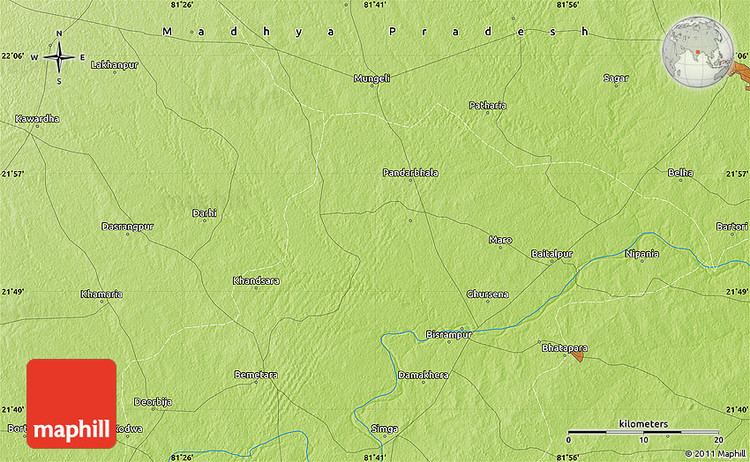
Map of Mungeli
Mungeli is a town and a municipality in Mungeli district in the Indian state of Chhattisgarh. Pin code of Mungeli is 495334. Mungeli is a newly formed district from the separation of bilaspur district.
Contents
Geography
Mungeli is located at 22.07°N 81.68°E / 22.07; 81.68. It has an average elevation of 288 metres (944 feet). Mungeli is located near the bilaspur district around 35 kilometres from the bilaspur and 100 kilometres away from the capital city of chhattisgarh 'Raipur'
Demographics
As of 2013 India census, Mungeli had a population of 55,756. (est) Males constitute 52% of the population and females 48%. Mungeli has an average literacy rate of 69%, higher than the national average of 59.5%: male literacy is 78%, and female literacy is 59%. In Mungeli, 13% of the population is under 6 years of age.