
Country State | Language spoken District | |
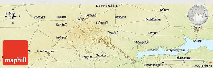 | ||
Map of Mundargi
Mundaragi is a municipal town in Gadag district in the Indian state of Karnataka. Mundargi is close to two district headquarters, being about 36 kilometres (22 mi) from Gadag and around 50 kilometres (31 mi) from Koppal. Mundargi is also the taluka headquarter of the same name. Pin code of Mundaragi is 582118.
Contents
- Map of Mundargi
- Hallikeri mundargi gadag
- Geography
- Demographics
- Mundaragi Fort
- Schools and Colleges
- Transportation
- History and Culture
- Places near Mundargi
- References
The name 'Mundaragi' is said to have derived from the stone hill, located to north-west of the town,Murudagiri, meaning 'Hill of Shiva'. The river Tungabhadra flows about 7 kilometres (4.3 mi) from Mundargi, and provides water for the town.
Hallikeri mundargi gadag
Geography
Mundargi is located at 15.22°N 75.9°E / 15.22; 75.9. It has total area of 6.64 km2. It has an average elevation of 528 metres (1,732 ft). Surrounded by the Kappatagiri range of hills, Mundargi has frequent droughts.
Demographics
As of 2011 India census, the Mundargi Town Municipal Council has population of 24,919 of which 12,513 are males while 12,406 are females.
Population of Children with age of 0-6 is 3215 which is 12.90% of total population of Mundargi (TMC). In Mundargi Town Municipal Council, Female Sex Ratio is of 991 against state average of 973. Moreover, Child Sex Ratio in Mundargi is around 886 compared to Karnataka state average of 948. Literacy rate of Mundargi city is 79.15% higher than state average of 75.36%. In Mundargi, Male literacy is around 86.82% while female literacy rate is 71.53%.
Mundaragi Fort
Mundaragi is famous for the ancient Mundaragi fort located on the hill top.
Schools and Colleges
Mundargi has many educational institutions:
Transportation
By road, Mundaragi is 37 kilometres (23 mi) south-east of Gadag and 32 kilometres (20 mi) south-west of Koppal. The nearest railway stations are at Gadag Junction and Koppal, and the nearest airport is at Hubli.
History and Culture
Mundargi town has a history of over 400 years. In 1857, during the Sepoy mutiny, Bheemarao Nadagouda, being a British official, rebelled against the British East India company and confiscated huge amounts of revenue. He was killed near the fort of Koppal . An ancient temple of Lord Narsimha, built by Rangarao Nadgauda in the early 18th Century, is built on the stone hill. Shri Kanaka Narsimha Jatre is held during Holi every year. Holi is not celebrated here. It is also famous for the Annadaneeshwara Matha. Annadaneeshwara was a veerashaiva monk, known for his generosity and annadaanam (alms of food). A jatre in his name is celebrated in the months of January–February every year.
Places near Mundargi
Mundargi is near to many historical and religious places. Dambal, located at a distance of 18 km from Mundargi, is home to Kalyani Chalukya archiological remnants. A famous Veerabhadra Temple is in Singatalur, about 20 km from Mundargi. Madalaghatta, about 12 km away and just across the Tungabhadra river, is home to a famous Hanuman Temple. Kappatta Hills range is a conserved forest and is home to diverse flora and fauna.