
Website Official website Administrative division Konkan division Tehsil 1. | Major highways NH-3, NH-8, Area 446 km² Major highway National Highway 3 | |
 | ||
Lok sabha constituencies Mumbai North West, Mumbai North East, Mumbai North Central, Mumbai South Central Points of interest Sanjay Gandhi National, Kanheri Caves, EsselWorld, Basilica of Our Lady of the Mount, Powai Lake Colleges and Universities University of Mumbai, Tata Institute of Social Sci, Indian Institute of Technolo, Narsee Monjee Institute o, Mithibai College | ||
Mumbai Suburban District is a district of Maharashtra in Konkan Division. Its headquarters is in Bandra. It consists of three administrative subdivisions : Kurla, Andheri, and Borivali. The district along with Mumbai City district and other suburban communities make up the metropolis of Mumbai on Salsette Island. The district occupies an area of 446 km².
Contents
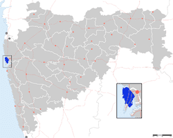
Map of Mumbai Suburban, Maharashtra
This is the second smallest district of Maharashtra, and it administratively comes under Konkan Division.
The jurisdiction of Mumbai Suburban District is from Bandra to Dahisar, from Kurla (Chuna Bhatti) to Mulund and from Kurla up to Trombay Creek.
Mumbai Suburban District is one of the largest districts in the country by population. The current population is 9,332,481, according to the 2011 census, making it the fifth most populous district in India (out of 672). The Mithi River is the main river in the district.
History
Mumbai Suburban district was created on 1 October 1990 when Greater Mumbai bifurcated into Mumbai City and Mumbai Suburban district.
Geography
Many important places have adorned the beauty of this district, including Mount Mary Church, Jogeshwari Caves, Mahakali Caves, Essel World Water Kingdom, Marve Beach, Aksa Beach, Madh Island, Malwani, Sanjay Gandhi National Park, Aarey Colony, Kanheri Caves, Film City, Tulsi Lake, Vihar Lake and Powai Lake.
Demographics
According to the 2011 census, Mumbai Suburban district has a population of 9,332,481, roughly equal to the nation of Benin or the US state of North Carolina. This gives it a ranking of 5th in India (out of a total of 640). The district has a population density of 25,291.28 inhabitants per square kilometre (65,504.1/sq mi) . Its population growth rate over the decade 2001-2011 was 8.01%. Mumbai Suburban has a sex ratio of 857 females for every 1000 males, and a literacy rate of 90.9%.