
OSI/OSNI grid C739008 Prominence 235 m Listing Marilyn | Elevation 550 m Province Ulster Parent range Sperrins | |
 | ||
Topo map OSNI Discoverer Series 8 (1:50000) Similar Mullaghcarn, Lougher, Slieve Gallion, Benbradagh, Bel Mountain | ||
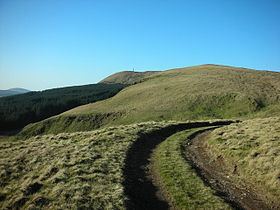
Mullaghmore (from Irish an Mullach Mór, meaning 'the big summit') is a mountain in County Londonderry, Northern Ireland. It is part of the Sperrins and the 359th highest mountain in Ireland The summit is dominated by a large telecommunication tower. The mountain is located 5 miles north of the village of Draperstown, and 6 mile south of Dungiven. It is also locally known as, "The Birren" hence the road name passing over the mountain, "Birren Road"
Map of Mullaghmore, Londonderry, UK
References
Mullaghmore, County Londonderry Wikipedia(Text) CC BY-SA