
Official name Mula Dam Opening date 1972 Impounds Mula river Height 48 m | Location Rahuri Type of dam EarthfillGravity Length 2,856 m (9,370 ft) Surface area 53,600 km² | |
 | ||
Similar Mandohol Dam, Ahmednagar Fort, Nilwande Dam, Farah Bagh, Cavalry Tank Museum | ||
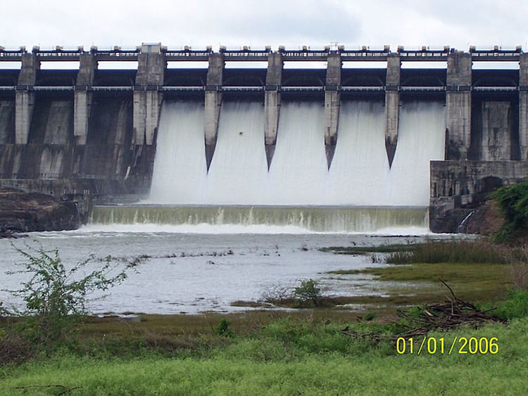
Mula Dam is an earthfill and gravity dam on Mula river near Rahuri in Ahmednagar district of the state of Maharashtra in India.
Contents
Map of Mula Dam, Wawarath, Maharashtra 413705
Specifications
The height of the dam above lowest foundation is 48.17 m (158.0 ft) while the length is 2,856 m (9,370 ft). The volume content is 7,594 km3 (1,822 cu mi) and gross storage capacity is 736,320.00 km3 (176,652.56 cu mi)Water capacity is 26 TMC.
Purpose
References
Mula Dam Wikipedia(Text) CC BY-SA