
Vehicle registration WB Population 447 (2011) | Time zone IST (UTC+5:30) Website wb.gov.in Local time Tuesday 2:10 PM | |
 | ||
Weather 33°C, Wind NW at 11 km/h, 19% Humidity | ||
Mukutmanipur forest
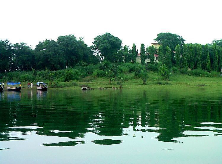
Mukutmanipur is a town in Bankura district of West Bengal, India. It is located at the confluence of the Kangsabati and Kumari rivers close to the Jharkhand border.
Contents
- Mukutmanipur forest
- Map of Mukutmanipur West Bengal 722135
- Kangsabati project
- Notable attractions
- Demographics
- Transport
- References
Map of Mukutmanipur, West Bengal 722135
Kangsabati project
In 1956, a giant water dam reservoir was planned at Mukutmonipur, [about 12 km from Khatra town in the district of Bankura, WB], under a big vision mooted by the then CM of Bengal Dr Bidhan Ch. Roy. The Mukutmonipur dam was planned to provide major irrigation facilities to 8,000 square kilometres of agricultural land, stretched across Bankura, Purulia, Paschim Medinipur and parts of upper Hooghly. Approximately two kilometres from the lake is the Bangopalpur Reserve Forest, a home of many species of flora and fauna.
Notable attractions
Mukutmonipur and Jhilimili nearby are major tourist attractions visited by more than a lakh (100 000) visitors. The second biggest earth dam of India is located in Mukutmonipur 55 km away from Bankura. According to one description, “green forests surround the vast bluish tract of water, and the hillocks are picturesque. The place is very famous for its superb natural beauty. The undulating terrain along the southern edge of the Kangsabati water reservoir spreads as a three-dimensional necklace in green and terracotta.” The SDO, Khatra, Mr Sanjay Vansal said: “We have got a Rs 80 lakh composite UNDP project for Mukutmonipur. The project has been conceived to promote tourism and improve the condition of the tribal artisans devoted to the craft work with bamboo sticks and saboi grass.”
Approximately two kilometers from the lake is the Bangopalpur Reserve Forest, a home of many species of flora and fauna. Four kilometres from the dam is the ancient town of Ambikanagar, once an important place of pilgrimage for Jains. However, a flood destroyed most of what remained in 1898.
Mukutmanipur is home to the world’s reportedly longest (10.8 km) man-made mud-banked fresh water barrage that canalises Kangshabati & Kumari rivers into the three drought affected districts of Bankura, Purulia & Midnapore for irrigation in the summer months.
Demographics
As per 2011 Census of India Mukutmanipur had a total population of 447 of which 240 (54%) were males and 207 (50%) were females. Population below 6 years was 40. The total number of literates in Mukutmanipur was 328 (80.59% of the population over 6 years).
Transport
The Union Railway Minister laid the foundation stone of the new 47 km Bankura-Chhatna-Mukutmanipur line in 2005.