
Basin area 496 km² Mouth elevation 0 | Country Japan | |
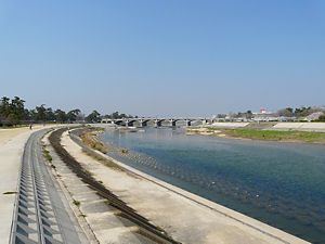 | ||
The Mukogawa River or Muko River (武庫川, Mukogawa) is a river in the south-eastern part of Hyōgo Prefecture. This river was selected as the second most important river in the region by the prefecture governor. Its total length is 66 kilometers, and the drainage area is 496 square kilometers.
Contents
Map of Muko-gawa, Japan
Description
The Muko River originates at Mount Shirakami (白髪山, Shirakami-yama) in the Tanba Highland. It flows through the Sanda Basin, and creates the Mukogawa Keikoku Ravine between Sanda and Takarazuka. It continues into Osaka Plain at Takarazuka, and flows in the Osaka Metropolitan Area to create the borders between Takarazuka and Itami as well as between Nishinomiya and Amagasaki. This river flows into Osaka Bay, and was used to transport the Kohama style of sake from the Kohama-juku (小浜宿) in Amagasaki Domain of Settsu Province during the Edo period.