
Type Highway Length 161 km | Route number(s) State Route 102 | |
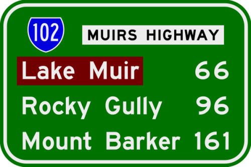 | ||
Major settlements Lake Muir, Rocky Gully, Western Australia | ||
Muirs Highway is a Western Australian highway linking Manjimup and Mount Barker on the Albany Highway. It is signed as State Route 102 and is 161 kilometres (100 mi) long. It provides a shorter distance between Manjimup and Albany. It is a lonely highway surrounded with karri and jarrah forests with no settlements in between except the small farming settlement of Rocky Gully.
Map of Muirs Hwy, Western Australia, Australia
Muirs Highway was named after brothers Thomas and John Muir, the first European settlers in the Warren district, who settled at Deeside in 1852 and built a rush hut there in 1856.
References
Muirs Highway Wikipedia(Text) CC BY-SA