
Max. length 11 km (6.8 mi) Surface area 46 km (18 sq mi) Area 4 km² Width 3 km Catchment area 384 km² | Basin countries Australia Max. width 5 km (3.1 mi) Surface elevation 170 m Length 12 km Catchment area 384 km² | |
 | ||
Designation Muir-Byenup System Ramsar Site | ||
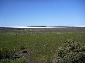
Lake Muir is a freshwater lake, with a larger surrounding wetlands area, that is located in the South West region of Western Australia. The lake lies near Muirs Highway, north of Walpole and southeast of Manjimup. The lake has a surface area of 46 square kilometres (18 sq mi).
Contents
Map of Lake Muir, WA 6258, Australia
Lake Muir and its surrounding wetland lies within the Lake Muir-Unicup System, a 694 square kilometres (268 sq mi) area of internal drainage containing a complex of wetland systems. Lake Muir may, in flood, overflow southwest into the Deep River catchment (and possibly also southeast into the Frankland River via Poorginup Gully).
Lake Muir is usually brackish (1000–3000 mg/L TDS) at the end of winter, saline by summer and dry throughout autumn.
Flora and fauna
A 14-square-kilometre (5.4 sq mi) section of wetland around Lake Muir has been identified by BirdLife International as an Important Bird Area (IBA) because it provides habitat for 10 or more pairs of endangered Australasian bitterns. The wetlands within the IBA are shallow with extensive beds of dense sedgeland and fringing stands of shrubland and woodland. Lake Muir has been excluded from the IBA as it is unsuitable for bitterns but it has supported large numbers of Australian Shelduck and may prove to be globally significant for that species.
History
Lake Muir was named after brothers Thomas and John Muir, the first European settlers in the Warren district, who settled at Deeside, 25 kilometres (16 mi) west of the lake, in 1852 and built a rush hut there in 1856.
Historically the area was a Game Reserve, with a duck shooting season. The Department of Environment and Conservation (CALM) started monitoring the wetlands system in 1980 in order to manage the duck shooting.
On 5 January 2001 a 106 square kilometres (41 sq mi) area was designated, under the Ramsar Convention as Ramsar site 1050, a wetland of international importance, acknowledging its rich ecological diversity.