
Total islands 1 Length 18 km (11.2 mi) Area 49.3 km² | Major islands Muharraq Width 5.5 km (3.42 mi) Elevation 10 m | |
 | ||
Adjacent body of water Persian Gulf (also known as Arabian Gulf) | ||
Muharraq Island (Arabic: جزيرة المحرق), formerly known as Moharek, is the second largest island in the archipelago of Bahrain after Bahrain Island. It has a distance of 4 km (2.5 mi) east of the capital, Manama, on Bahrain Island.
Contents
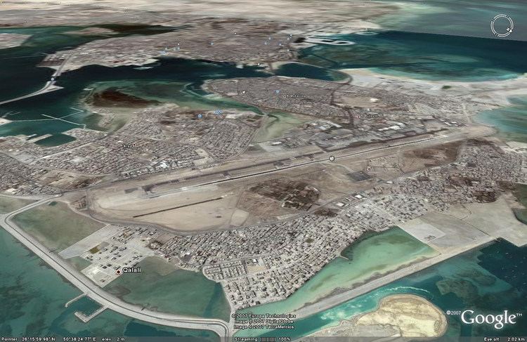
- Map of Muharraq Island Muharraq Bahrain
- History
- Demography
- Administration
- Transportation
- Bibliography
- References
Map of Muharraq Island, Muharraq, Bahrain
History
It is named after Muharraq City, the former capital of Bahrain. The Al Khalifa dynasty settled there in the nineteenth century and resided there until 1923. The island dominated trade, fishing and especially pearls industries in Bahrain. The Pearl center was made a UNESCO world heritage site in 2012. In recent years, north of Muharraq Island have a major reclamation of some artificial islands like Amwaj Islands. The south of the island, at Hidd district, the new Bahrain International Investment Park of the free zone (BIIP) was built. And in the far south, new Khalifa bin Saruman harbor, which opened in 2009.
Demography
There are several towns and villages located on the Island, including:
Administration
The island belongs to Muharraq Governorate.
Transportation
The island has the 4,000 metres (13,000 ft) Bahrain International Airport (IATA: BAH, ICAO: OBBI) that follows the long east–west axis. The island has the 900 metres (3,000 ft) Muharraq Airfield (ICAO code:none) adjacent to Bahrain International Airport. There are three causeways connecting Muharraq Island with Manama on Bahrain Island: