
Car plates NMR | Area 1,065 km² | |
 | ||
Points of interest Vandens pramogų parkas „T, Miasteczko Westernowe Mrongoville, Muzeum Sprzętu Wojskow, Ośrodek Wczasowy Ostrów Pi, Muzeum Warmii i Mazur Destinations Mrągowo, Mikołajki, Śniardwy, Krutyń, Łuknajno Lake | ||
Mrągowo County (Polish: powiat mrągowski) is a unit of territorial administration and local government (powiat) in Warmian-Masurian Voivodeship, northern Poland. It came into being on January 1, 1999, as a result of the Polish local government reforms passed in 1998. Its administrative seat and largest town is Mrągowo, which lies 54 kilometres (34 mi) east of the regional capital Olsztyn. The only other town in the county is Mikołajki, lying 21 km (13 mi) east of Mrągowo.
Contents
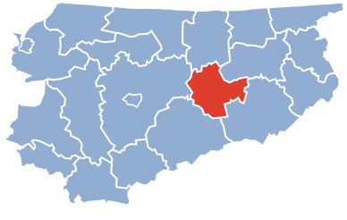
Map of Mr%C4%85gowo County, Poland
The county covers an area of 1,065.23 square kilometres (411.3 sq mi). As of 2006 its total population is 50,087, out of which the population of Mrągowo is 21,772, that of Mikołajki is 3,848, and the rural population is 24,467.
Neighbouring counties
Mrągowo County is bordered by Kętrzyn County to the north, Giżycko County to the east, Pisz County to the south-east, Szczytno County to the south and Olsztyn County to the west.
Administrative division
The county is subdivided into five gminas (one urban, one urban-rural and three rural). These are listed in the following table, in descending order of population.