
- left Gully Creek - elevation 189 m (620 ft) - elevation 0 m (0 ft) Mouth Bass Strait | - location near Stonefield - location Port Fairy Basin area 797 km² | |
 | ||
- right Back Creek (Moyne Shire, Victoria) | ||
The Moyne River, a perennial river of the Glenelg Hopkins catchment, is located in the Western District of Victoria, Australia.
Contents
Map of Moyne River, Victoria, Australia
Course and features
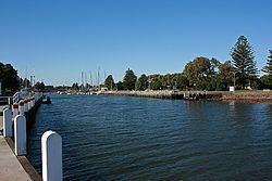
The Moyne River rises near Stonefield, from the edge of the lava flows west-southwest of Penshurst. The river flows generally south, joined by two minor tributaries, and spilling into the Belfast Lough and then reaching its mouth and emptying into Port Fairy Bay in the Bass Strait near Port Fairy. The river descends 190 metres (620 ft) over its 82-kilometre (51 mi) course.
The mouth of the river has been significantly altered. The river originally spilled into the Bass Strait south of the town of Port Fairy through a series of narrow channels leading westward from the site of the present–day mouth. At that stage, the southern outlet of the Moyne, the Back Passage, was narrow and the opening to the sea was often too rough for boats to leave or enter the port; the main eastern outlet was blocked by a shallow sand bar. These navigational impediments led to the construction of a jetty from Flagstaff Hill and a boulder wall breakwater between Griffiths Island and Rabbit Island. Training walls constructed in the 1870s, curve from the northern part of Griffiths Island through the sand bar. These structures rapidly led to the accumulation of large amounts of sand on the north coast of Griffiths Island and back shore erosion north of the breakwaters. A protective stone wall was added in 1911.