
Country United States Elevation 1,001 ft (305 m) Area code(s) 740 Zip code 43050 Local time Monday 5:30 AM | State Ohio Time zone Eastern (EST) (UTC-5) FIPS code 39-53102 Population 16,798 (2013) | |
 | ||
Weather -1°C, Wind SE at 5 km/h, 97% Humidity Colleges and Universities Mount Vernon Nazarene University, Knox County Career Center | ||
Lake hiawatha amusement park mount vernon ohio
Mount Vernon is a city in Knox County, Ohio, United States. The population was 16,990 at the 2010 census. It is the county seat of Knox County.
Contents
- Lake hiawatha amusement park mount vernon ohio
- Map of Mt Vernon OH 43050 USA
- History
- Historic sites
- Geography
- 2010 census
- 2000 census
- Economy
- Colleges and universities
- High schools
- Notable people
- References
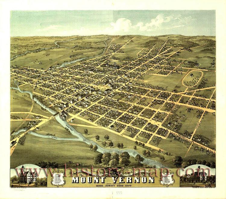
Map of Mt Vernon, OH 43050, USA
History
The community was platted in 1805, and named after Mount Vernon, the plantation owned by George Washington.
On January 1959 a severe flood caused 500 homes to be evacuated and caused $5 million in damage. In August 2006, an F0 tornado touched down on the west side of town. It demolished a barn at the local 84 Lumber, and the resulting debris blew across the road to the DeCosky GM car dealership. It caused at least $150,000 of damage.
Historic sites
The Woodward Opera House, the oldest opera theater of its kind in the United States, is located downtown. The theater is currently under major renovation and will, upon its completion, be transformed into a local cultural and performing-arts center.
The Knox County Historical Society, with a building and extensive exhibits, makes its headquarters on Harcourt Road in Mount Vernon. Exhibits feature information about Daniel Decatur Emmett, Paul Lynde, The Cooper Company and other subjects.
Geography
Mount Vernon is located at 40°23′34″N 82°28′52″W (40.392738, −82.481151).
According to the United States Census Bureau, the city has a total area of 9.60 square miles (24.86 km2), of which 9.41 square miles (24.37 km2) is land and 0.19 square miles (0.49 km2) is water. The city lies in the Glaciated Allegheny Plateau and is surrounded by rolling hills and valleys.
The Kokosing River and U.S. Route 36 pass through the city.
2010 census
As of the census of 2010, there were 16,990 people, 7,110 households, and 4,016 families residing in the city. The population density was 1,805.5 inhabitants per square mile (697.1/km2). There were 7,836 housing units at an average density of 832.7 per square mile (321.5/km2). The racial makeup of the city was 95.3% White, 1.1% African American, 0.2% Native American, 1.1% Asian, 0.7% from other races, and 1.5% from two or more races. Hispanic or Latino of any race were 1.8% of the population.
There were 7,110 households of which 28.3% had children under the age of 18 living with them, 38.4% were married couples living together, 13.6% had a female householder with no husband present, 4.4% had a male householder with no wife present, and 43.5% were non-families. 38.0% of all households were made up of individuals and 16.5% had someone living alone who was 65 years of age or older. The average household size was 2.19 and the average family size was 2.88.
The median age in the city was 37.2 years. 21.8% of residents were under the age of 18; 13.7% were between the ages of 18 and 24; 23.2% were from 25 to 44; 24% were from 45 to 64; and 17.3% were 65 years of age or older. The gender makeup of the city was 46.5% male and 53.5% female.
2000 census
As of the census of 2000, there were 15,256 people, 6,187 households, and 3,730 families residing in the city. The population density was 1,710.4 people per square mile (660.7/km²). There were 6,713 housing units at an average density of 798.7 per square mile (308.6/km²). The racial makeup of the city was 96.66% White, 1.15% African American, 0.31% Native American, 0.54% Asian, 0.29% from other races, and 1.04% from two or more races. Hispanic or Latino of any race were 0.87% of the population.
There were 6,187 households out of which 28.0% had children under the age of 18 living with them, 43.8% were married couples living together, 12.7% had a female householder with no husband present, and 39.7% were non-families. 34.2% of all households were made up of individuals and 16.1% had someone living alone who was 65 years of age or older. The average household size was 2.25 and the average family size was 2.88.
In the city the population was spread out with 23.7% under the age of 18, 10.1% from 18 to 24, 27.2% from 25 to 44, 20.7% from 45 to 64, and 18.3% who were 65 years of age or older. The median age was 37 years. For every 100 females there were 86.2 males. For every 100 females age 18 and over, there were 81.3 males.
The median income for a household in the city was $29,801, and the median income for a family was $38,217. Males had a median income of $31,900 versus $21,969 for females. The per capita income for the city was $16,471. About 12.7% of families and 15.6% of the population were below the poverty line, including 20.7% of those under age 18 and 9.2% of those age 65 or over.
Economy
Mount Vernon was the birthplace of Cooper Industries. There is a large industrial complex in the western part of the city that manufactures and repairs products for the gas and oil power generation industries. It was acquired by Rolls-Royce North America, and in 2014 Siemens bought the Mount Vernon plant. Face a declining market, the company has announced major reductions in employment.
Ariel Corporation, a major manufacturer of reciprocating natural gas (and other gasses) compressors, is also located in Mount Vernon. Its history is tied to that of Cooper Industries in that Jim Buchwald, one of the founders of Ariel, was a former engineer for Cooper Industries Mount Vernon. Ariel's website can be found at arielcorp.com.
In November 2012, Harvest@TheWoodward opened to provide a market for locally grown and produced foods all year long. Products in the store are Ohio made, grown and produced. They have been continuously bringing in new products from local farmers and producers across Ohio. They carry seasonal produce and herbs, milk, goat milk, cheese, eggs, yogurt, beef, chicken, pork, lamb, goat, lard, bread, granola, cookies, noodles, cakes, relish, jams, jellies, syrups, candy, goat milk fudge, pickles, butters, dip mixes and chips as well as Ohio gifts and much more.
Two universities in Mount Vernon and nearby Gambier provide thousands of jobs to the local residents. Mount Vernon is home to Mount Vernon Nazarene University and Gambier is home to Kenyon College.