
Topo map USGS Portland Prominence 6 m | Elevation 465 m Parent range Kittatinny Mountain | |
 | ||
Easiest route Mount Tammany Trail ascending the western slopes from the Dunnfield Creek trailhead (hike) Mountain range Appalachian Mountains, Kittatinny Mountain Similar Mount Minsi, High Point, Sunrise Mountain, Cushetunk Mountain, The Pinnacle | ||
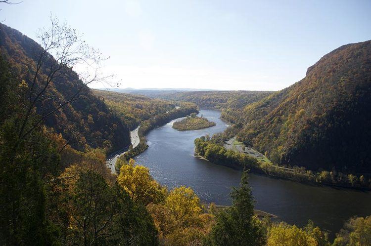
Worthington state forest mount tammany new jersey 2004
Mount Tammany is the southernmost peak of the Kittatinny Mountains in Knowlton Township, Warren County, New Jersey, United States. It is 1,526 feet (465 m) tall, and forms the east side of the Delaware Water Gap. Across the Gap is Mount Minsi, on the Pennsylvania side of the river. The mountain is named after the Lenni Lenape chief Tamanend. It lies along the Appalachian Trail in Worthington State Forest. The summit can be hiked by the Mount Tammany Trail ascending the western slopes. This trail head is accessible from Interstate 80.
Contents
- Worthington state forest mount tammany new jersey 2004
- Map of Mount Tammany Knowlton Township NJ 07832 USA
- References
Map of Mount Tammany, Knowlton Township, NJ 07832, USA
References
Mount Tammany Wikipedia(Text) CC BY-SA