
Elevation 2,956 m | ||
 | ||
Similar Lake Ngozi, Namarunu, Emuruangogolak, Harrat al Birk, Barrier Volcano | ||
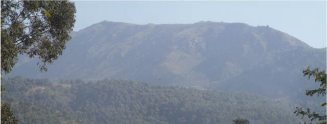
Mount Rungwe is a potentially active volcano in the Mbeya Region of the southern highlands of Tanzania. At an altitude of 2,981 metres (9,780 ft), it is southern Tanzania's second highest peak. Rungwe stands at the junction of the eastern and western arms of the East African Rift. It dominates the mountainous country at the north-west end of the trough that contains Lake Nyasa. The southeastern slopes of these mountains receive up to 3 metres (9.8 ft) of rainfall a year, the highest rainfall in Tanzania. The slopes are covered with a belt of tropical montane forest. Above the treeline, at about 2,600 metres (8,500 ft), there is a belt of heathland. Much of the mountain was listed as a Forest Reserve as early as 1949. The last volcanic eruption probably happened a few hundred years ago.
Contents
Map of Mount Rungwe, Tanzania
The genus of monkey, Rungwecebus that was named for the mountain in 2005 was initially thought to be a type of mangabey from the genus Lophocebus, until more detailed genetic analysis showed its closer connection to baboons.
Possible renewed activity
On 20 December 2009 a magnitude 6.0 earthquake hit near the town of Karonga in Malawi, ca. 90 km SE of Rungwe. The earthquake damaged school buildings, houses, police stations, health centers and boreholes. Since December 2009 at least 30 earthquakes have hit the northern district of Karonga, killing four people, injuring at least 180 and affecting 145,000 others. These are the largest earthquakes in the area since 1966 when a magnitude 6.2 earthquake hit. Earthquake swarms often precede volcanic eruptions, but there is no evidence to suggest that the Karonga earthquakes were at all associated with volcanic activity.