
 | ||
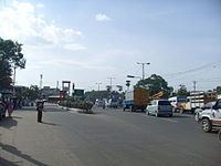
St. Thomas Mount-Poonamallee Road, popularly known as the Mount-Poonamallee Road (SH-55), is an arterial road in the city of Chennai, India. It runs for 11 kilometres from Kathipara Junction to the NH 4 highway connecting St. Thomas Mount with the suburb of Poonamallee. About 5 kilometres of the Mount-Poonamallee Road is located in the Tambaram taluk of Kancheepuram district and the remainder in the Poonamallee taluk of Thiruvallur district.
Contents
Map of Mount Poonamalle High Rd, Chennai, Tamil Nadu
Features
The road is divided into two sections. The first section from St. Thomas Mount to Nandambakkam covering a distance of one kilometre is more narrow than the rest of the stretch and is known as Butt Road.
Places transversed
References
Mount-Poonamallee Road Wikipedia(Text) CC BY-SA