
Elevation 2,817 m | Mountain type Unknown Last eruption 1994 | |
 | ||
Similar Belirang‑Beriti, Iliwerung, Iliboleng, Inierie, Ilimuda | ||
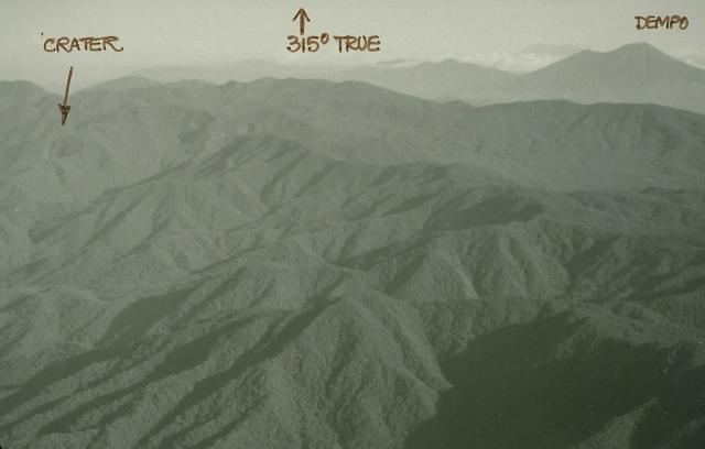
Mount Patah (Indonesian: Gunung Patah, means: Broken Mountain) is a heavily forested quaternary age volcano southeast of Mount Dempo on Sumatra island, Indonesia. On 1 May 1989, a fumarole activity was observed by a pilot near the summit. The exact location of the crater, the date of its formation and its geologic relationship is uncertain.
Map of Mount Patah, Bungin Tambun III, Padang Guci Hulu, Kaur Regency, Bengkulu, Indonesia
Mount Patah is in a protected forest area King Mendara, with a total area of 42.567 hectares. The peak of the mountain is located on the border of the province of Bengkulu and South Sumatra with a height of 2,817 meters above sea level, in the western part there is a crater sulfur which is located into the region of Bengkulu province at an altitude of 2,600 meters above sea level, in the southern part of the crater there is a volcanic lake with an altitude of 2,550 meters above sea level
Has been pioneering many mountainering conducted by MAPALA, among them Kampala Faperta UNIB 2002, 2015, Palasostik UNIB 2007, Mapala UMY 2015.