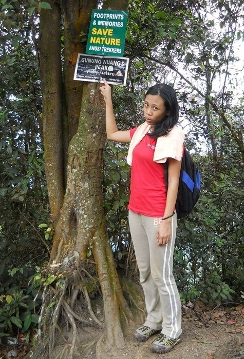
Elevation 1,493 m | Mountain range Titiwangsa Mountains | |
 | ||
Similar Mount Irau, Mount Tahan, Mount Ophir, Gunung Kutu, Mount Korbu | ||
Endurance test mount nuang a day hike to the peak 1495m 8 6km grade 8 6 deg
Mount Nuang (Malay: Gunung Nuang) is located in Malaysia with the height of 1,493 metres (4,898 ft). Its peak borders Pahang and Selangor state and is close to the Pahang-Selangor-Negeri Sembilan border tripoint. The mountain itself is the highest point in Selangor and part of the Titiwangsa Mountains.
Contents
- Endurance test mount nuang a day hike to the peak 1495m 8 6km grade 8 6 deg
- Mount nuang gunung nuang paul lim s studio company trip
- References
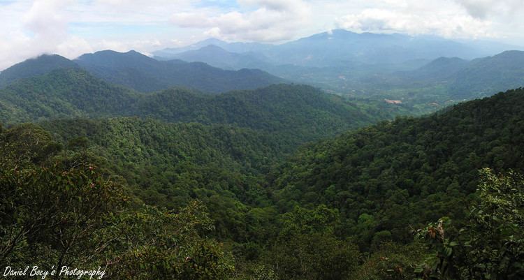
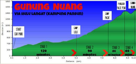
There are three hiking routes to the peak and all of them were built by Malaysian Department of Wildlife and National Parks. Two of them start in Selangor; one at Kuala Pangsoon in Hulu Langat and another at Kampung Kemensah in Gombak. The third path originates from Bukit Tinggi in Bentong, Pahang. Genting Highlands is visible at night from the peak. On the Kuala Pangsoon rout, the climb involves a two-hour hike on a very steep road, then an optional stop at "Camp Lolo", and after that there is a six-hour push to the peak, and a four-hour trek to the ground.
Mount nuang gunung nuang paul lim s studio company trip