
Parent range Sierra Nevada Elevation 3,731 m Prominence 180 m Mountain range Sierra Nevada | Easiest route Scramble, class 2 First ascent 1928 | |
 | ||
Listing SPS Mountaineers peakWestern States Climbers Star peak Similar Laurel Mountain, Red Slate Mountain, Bloody Mountain, Mount Russell, Bear Creek Spire | ||
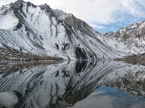
Mount Morrison is located in the Sierra Nevada, in the Sherwin Range. It rises south of Convict Lake near the town of Mammoth Lakes.
Contents
Map of Mt Morrison, California 93546, USA
HistoryEdit
The mountain was named for Robert Morrison, a merchant in the town of Benton, who was killed near Convict Lake on September 23, 1871 while was acting as member of a posse pursuing escaped convicts from the Nevada State Penitentiary. Nearby is Mono Jim Peak which is named for Mono Jim, a Paiute guide, who died in the same gun fight.
ClimbingEdit
Sources state that Norman Clyde climbed to the peak on June 22, 1928 and that John Mendendhall also reached the summit in 1928 but the month of his ascent is not documented. There are several routes to the summit, the easiest consisting of a Class 2 scramble and bushwack.
Due to its imposing east face, Mount Morrison is also nicknamed the "Eiger of the Sierra." The east face consists of extremely loose rock and one should exercise extreme caution when attempting the face.
GeologyEdit
Fulgurites, natural hollow glass tubes, are found at the top of the mountain. These oddities are formed by lightning acting on certain types of sand or soil.